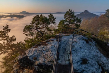
Enchanting stairs in the Schmilka basin


- 2:50 h
- 8.28 km
- 445 m
- 445 m
- 121 m
- 465 m
- 344 m
- Start: Schmilka
- Destination: Schmilka
Schmilka at the ferry terminal - hiking path to the Kleine Bastei - Rotkehlchenstiege - Wurzelweg - Schmilka

Good to know
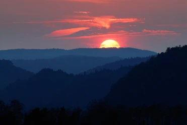
Best to visit
Directions
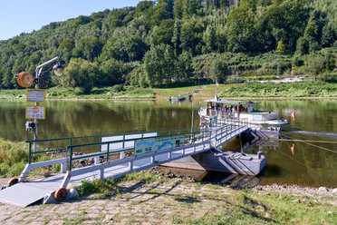
We start in Schmilka at the ferry terminal. First, we go a short way downstream of the Elbe (green line). The path meets the road and after a few meters a path branches off uphill on the right (Kahntilke). We cross a track, on which we go briefly to the right and then continue following the hiking trail to the Kleine Bastei.
For the further route, we stay on the path with the green line marking until we reach the Elbleitenweg. Here we turn right (green dot). We follow this wide forest track, which later leads downhill; we come to a right-hand bend and here we take the second path branching off to the left (Rotkehlchenstiege, green triangle for mountain path on the signpost). The path takes us at the end of the valley to the Rotkehlchenstiege.
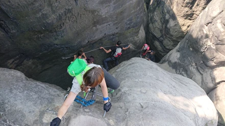
After the ascent, one level higher in the rock world, we turn right and follow the blue line marking. After a little more than 1 km, we make a detour to the right to enjoy a beautiful view into the rock landscape towards the Wenzelwand.
The path continues at almost constant altitude. At the junction to the Lehnsteig (signposted but unmarked), we turn right. We walk along a ridge and later descend stairs. Below, we reach the Wurzelweg, keep right and at the next large intersection turn downhill (yellow line, road), it goes partly quite steeply downhill and we arrive back in Schmilka.
GPS data updated 2021
Tour information
Loop Road
Equipment
sturdy footwear and provisions
Directions & Parking facilities
Parking lot in Schmilka at the ferry terminal (paid)
Additional information
Information point Schmilka
Tourist service in the guest house: 03502290030
Here you will find everything about hiking in the Elbe Sandstone Mountains.
Are you looking for a hotel, a holiday apartment or a holiday home in Saxon Switzerland?
All our hiking routes with free GPX download can be found directly on our website.
Literature
Order here: Hiking guides
Author´s Tip / Recommendation of the author
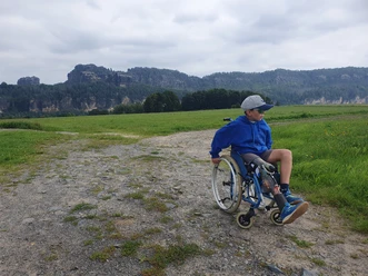
The route is suitable for children, but only conditionally for dogs.
Safety guidelines
Surefootedness and caution are required.
Map
Buy here: Hiking maps
Nearby

Download GPX file