To the rock gate of Neuer Wildenstein: the "Kuhstall"


- 1:25 h
- 4.07 km
- 174 m
- 168 m
- 160 m
- 329 m
- 169 m
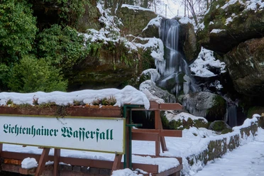
- Start: Lichtenhainer Waterfall (Kirnitzschtal)
- Destination: Beuthenfall (Kirnitzschtal)

Good to know
Best to visit
Directions
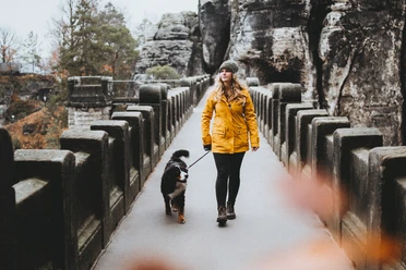
The start of the hike to the famous rock gate Kuhstall is at the Lichtenhainer Waterfall in the Kirnitzschtal. We cross the Kirnitzsch on the bridge and take the hiking trail marked with a red dot and M, following the signs to the immense rock hollow.
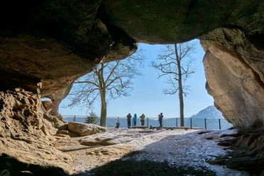
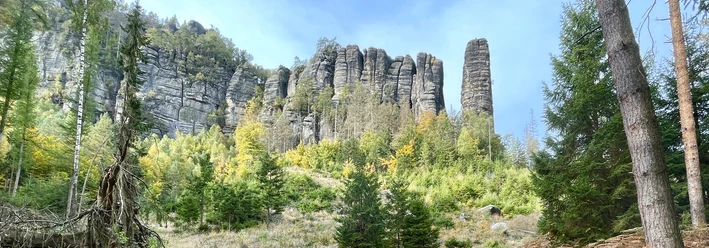
The Kuhstall is the largest stratification cave in Saxon Switzerland, formed through weathering and erosion connected with damming water. In the Middle Ages, the immense cave was out of necessity a 'cowshed' for the farmers’ cattle and a safe, protected hideout for people and animals in the deep forests. At that time, wars with roaming, plundering armies afflicted the land, and raids were common.
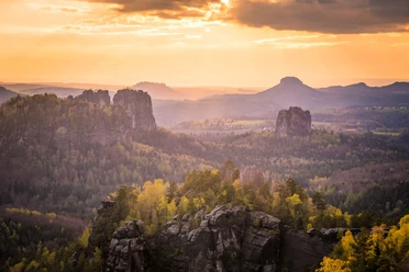
After passing through the Kuhstall, a narrow crevice with steps – the so-called Himmelsleiter – leads steeply up to the plateau with a wonderful view into the Kleiner Zschand and the Affensteine. Here in the 15th century stood the castle complex Neuer Wildenstein. After the comfortable descent from the plateau, we take the stairs down (marked with red dot and M). At the bottom, we meet the Hinterer Kuhstallweg (red line), which we follow for 500 meters before turning left onto the Räumichtweg, which leads into the Dittrichtsgrund. We follow this downhill in the direction of the Kirnitzschtal until we reach the Beuthenfall.
Tour information
Cultural Interesting
Stop at an Inn
Directions & Parking facilities
Outbound: Take bus 241 (direction Hinterhermsdorf) to the Lichtenhainer Waterfall or first take bus 241 to Bad Schandau Elbkai and then transfer to the Kirnitzschtalbahn to Lichtenhainer Waterfall
Return: Take bus 241 (direction Pirna) from Beuthenfall Kirnitzschtal or from Beuthenfall Kirnitzschtal take the Kirnitzschtalbahn to Bad Schandau and then transfer to bus 241
Author´s Tip / Recommendation of the author
Nearby