Polenztalweg


- 4:30 h
- 13.65 km
- 291 m
- 310 m
- 132 m
- 358 m
- 226 m
- Start: Porschdorf stop
- Destination: Porschdorf stop
Route: Porschdorf stop - Polenztal - Schindergraben - Hohnstein - Brandstraße - Brand - Brandstufen - Tiefer Grund - Porschdorf stop

Good to know
Pavements
Best to visit
Directions
Above the Alter Hockstein, the path turns right into the Schindergraben, which takes you up to Hohnstein Castle. Below the castle, you pass the remains of a once mighty barrier wall of the former bear garden. The ivy-covered ruins, through which a stream babbles, stand so perfectly eerily romantic between the slopes, as if they were just waiting to be painted by Caspar David Friedrich on a full moon night.
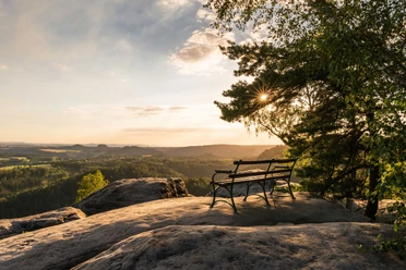
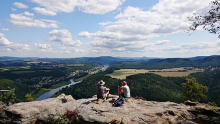
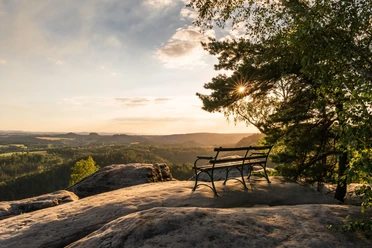
From Hohnstein, follow the blue line for around 30 minutes to the Brand viewpoint. Once you reach the "Balcony of Saxon Switzerland", you can enjoy a unique 180-degree panorama of the Polenz Valley, fields, forests, villages and the curious silhouettes of the Table Mountains on the horizon.
The epilogue of the tour is the 800 or so steps down into the valley. Once you reach Tiefen Grund, the Waitzdorfer Bach stream and the Polenz river accompany you along the blue line markings back to Porschdorf.
Tour information
Loop Road
Stop at an Inn
Equipment
- Onion-skin clothing and winter hiking boots
- Backpack with hiking map, snacks, thermos flask with a warm drink, smartphone, flashlight, first aid kit
- Hiking poles, ice goggles
Directions & Parking facilities
Polenztal Frintzthalmühle
from/to Porschdorf: National Park Railway
Timetable information: www.vvo-online.de
Additional information
Safety guidelines
Map
Nearby


Download GPX file