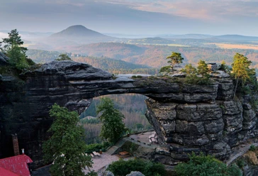
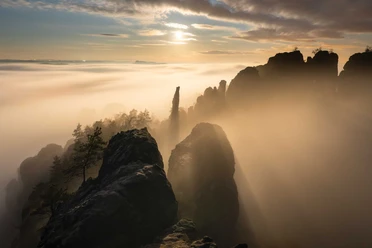
From Rauschenstein to Schrammsteine

- 3:20 h
- 11.26 km
- 268 m
- 265 m
- 116 m
- 337 m
- 221 m
- Start: Schmilka S-Bahn station
- Destination: Krippen S-Bahn station
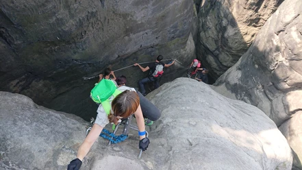
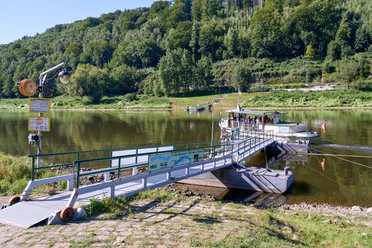
In Schmilka, on the other side of the Elbe, it first goes through the village, then steeply uphill in the forest. At the crossroads near Zwieselhütte, a shelter hidden to the right in the forest, we go straight ahead. At the next junction, we do the same and continue following the fairly wide forest road without deviating from it. After we have mastered the ascent, the Rauschenstein soon appears on the right. This climbing peak was at times a robber nest in the Middle Ages. Although it becomes quite bumpy in places due to gravel, we make good progress because there is only little uphill and downhill. Passing more rock ridges, we now hike to the Devil's Tower. Unfortunately, some small cross beams must be overcome here, which were built across the path to protect against soil erosion. The Devil's Tower is one of the most significant rock formations in the mountains. It is a pity that it is hidden behind the trees. After overcoming the few steps, there is a nice resting place. The route continues on the Elbleitenweg to the Schrammsteine. We leave the Schrammsteinweg junction on the right. Now the hike becomes a bit more strenuous again with frequent small downhill sections and ascents on partly difficult path conditions. Occasionally, short sections of crossed logs have to be managed. When the Vordere Torstein rises steeply to our right, these efforts are also overcome. Passing the so-called Schrammstein chain, we hike to the junction below the Schramm Gate. Here too, we continue straight ahead on the wide forest path. Soon the Falkenstein greets us with its approx. 100 m high rock faces, but undeterred we hike toward Wildwiese. We leave the first junction on the left because it goes better downhill on the wide path. Only at the second junction do we turn off to the large clearing. It offers a wonderful panorama and is excellent for resting. Heading westward, we soon reach Zahnsgrund on the Wenzelweg, where we follow the road further downstream until reaching Postelwitz. Along the Elbe, we hike on the footpath to the ferry, cross over, and reach the Krippen station downstream.

Good to know
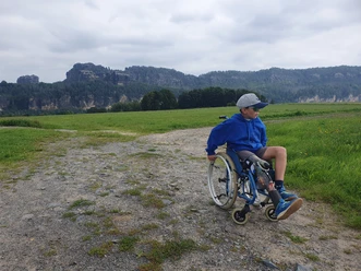
Pavements
Best to visit
Directions & Parking facilities
Safety guidelines
Please note: Only marked paths may be used in the core zone of the Saxon Switzerland National Park! Fines may be imposed for violations.
Nearby