Friendship Trail Saxon-Bohemian Switzerland


- 12:45 h
- 42.36 km
- 922 m
- 922 m
- 223 m
- 482 m
- 259 m
- Start: Hinterhermsdorf/Jetřichovice (Dittersbach)
- Destination: Hinterhermsdorf/Jetřichovice (Dittersbach)
There are two ways to walk the trail:
2-day tour:
1. Day 1: Start Hinterhermsdorf - finish Jetřichovice
Start: Hinterhermsdorf (Hoffnung bus stop) - Hackkuppe (yellow dot) - Hohweg - Grünstellige view - Königsplatz - Tunnelweg - Hinteres Schweineloch (red line) - Höllstraße -Zollstraße - Rabensteinaussicht - Rabensteinweg (green line) - Schleusenhornweg - Hermannsehornweg (red line).Rabensteinaussicht - Rabensteinweg (green line) - Schleusenhornweg - Hermannseck - Kirnirtzschklamm (blue line) - Rabendsteine - border Hinterhermsdorf/Hinterdittersbach - Česká silnice (green) - finish: Jetřichovice
2. Day: Start Jetřichovice - Finish: Hinterhermsdorf
Jetřichovice - Hřebenovka (ridge path) - Stezka Českem (blue) - Na Tokání - Stezka Českem (green) - Hinterhermsdorf/Hinterdittersbach border - Rabensteine -Kirnirnschklamm (blue line) - Hermannseck -Obere Schleuse (boat station) (red line) - Wettinweg (blue line) - Neue Straße (green line) - Lehmhübelweg - Kalkweg - Emmabank - Am Schäferräumicht - Weifberg - Panoramaweg Hinterhermsdorf (yellow dot) - Kräuterbaude - Hinterhersmdorf
Day tours:
Start/finish: Hinterhermsdorf
1. Stage: Hinterhermsdorf (Hoffnung bus stop) - Hinteres Räumicht - Kräuterbaude - Panoramaweg Hinterhermsdorf (yellow dot) - Weifberg - Am SchäferräEmmabank - Kalkweg - Lehmhübelweg - Neue Straße (green line) - Wettinweg (blue line) - Obere Schleuse (boat station) (red line) - Hermannseck - Schleusenhornweg - Rabensteinweg (green line) - Rabensteinaussicht - Zollstraße - Höllstraße - Hinteres Schweineloch (red line) - Tunnelweg - Königsplatz - Aussicht Grünstellige - Hohweg - Hackkuppe (yellow dot) - Hinterhermsdorf (Hoffnung bus stop)
Start/Finish:Jetřichovice
Jetřichovice - Kostelní stezka (Kirchweg) (blue) - Hřebenovka (Kammweg) - Na Tokáni -Stezka Českem (blue) - Stezka Českem (green) - border Hinterhermsdorf (yellow dot) - Hinterhermsdorf (green dot) - border Hinterhermsdorf (yellow dot).n) - Hinterhermsdorf/Hinterdittersbach border - Česká silnice (green) - Hřebenovka (ridge path) - Stezka Českem (blue) - Jetřichovice

Good to know
Pavements
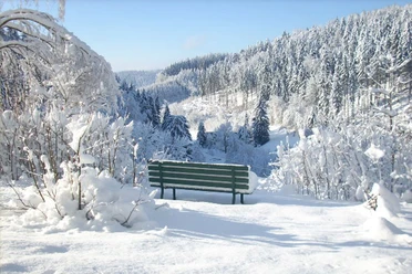
Best to visit
Directions
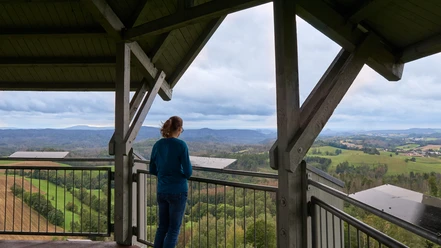
If you start at Kräuterbaude Saupsdorf, follow the Yellow Dot hiking trail. This is the Hinterhermsdorf panorama trail. It first leads up to the Weifberg, where the viewing tower offers magnificent views far into Saxon and Bohemian Switzerland as well as over Wachberg and Tanzplan. On a clear day, you can see as far as the Zittau Mountains. From Weifberg, we continue along the Panoaramaweg to Emmabank and back to Hinterhermsdorf. Only at the end of the village do we leave the yellow dot and now walk along the green line, partly on steps, down to the Obere Schleuse. At a crossroads, the Blue Line joins from the right, which we follow from now on, turning left.
Once we arrive at the Upper Lock, we have a choice: from Easter to the end of October, we can experience the anecdote-filled boat trip on the Kirnitzsch. Out of season, or for those who prefer to stay on land, there is the narrow path that winds its way up after the snack bar and ticket office and runs parallel to the Kirnitzsch to Hermannseck. This is also where visitors on the boat trip rejoin the hiking trail. An easy ascent (via steps) and a difficult ascent on a narrow metal staircase through a narrow rock passage lead up to Hermannseck. The ascent is rewarded with another beautiful view.
We now follow the red line towards Hinterhermsdorf for a short distance, but soon come to a fork in the path and turn left onto the green line. This path leads us to the Rabensteine with another viewpoint. After the view, the trail quickly descends. At the foot of the Rabensteine and thus back in the Kirnitzsch valley, we turn left and, after keeping right at the next fork, we can already see the bridge over the Kirnitzsch at the Zadní Jetřichovice (Hinterdittersbach) border crossing. Here we cross the national border and are now on the Czech part of the Friendship Trail.
Immediately after the border crossing, stay half right at the crossroads and keep left at the next fork. We follow wide, gravel paths, which are also used as cycle routes, through wide valleys for quite a while. We pass a crossroads on the way, but continue straight ahead until we finally turn left onto a narrower hiking trail at the Česká silnice customs post. This is marked in red and leads along the foot of the rocks; you are walking on the border of the Bohemian Switzerland National Park. We soon leave the path to the right to follow the blue markings to Jetřichovice.
In Jetřichovice, the trail leads past the information point. For hikers who want to spend the night in the former sanatorium, turn left after the information point; the hotel is then on the right at the end of the village. Otherwise, continue straight ahead along the road until you reach a crossroads and turn left through the forest up the hill to Rynartice. We cross a meadow. The next accommodation, the Zámeček wellness hotel, is on the right. The first stage for multi-day hikers ends in Jetřichovice or Rynartice.
The Friendship Trail follows the blue line to the left at the meadow, past Křížový vrch, and then winds gently up and down through the forest to the Balzhütte (Na Tokáni). Here you will find the ruins of a burnt-down inn and a refreshment stop a little further on. The route continues relaxed on the blue line along rocks through the forest. At a crossroads, we turn left onto the green-marked path, which finally takes us back to the border crossing.
Back on the German side, we walk back along the familiar path for a short distance, but do not turn back onto the Rabensteinweg, but onto the customs road at the next crossroads. We now follow the wide cycle route for a while until the Roter Strich hiking trail turns left into the tunnel path, which takes us steadily uphill, through a rock tunnel and over steps, finally taking us on a detour to Königsplatz. After enjoying the far-reaching view from here, which was already appreciated by the Saxon King Friedrich August II, we follow the Roter Strich back to Hinterhermsdorf.
Opposite the Buchenparkhalle inn, we turn left and find ourselves back on the Yellow Dot, which we already know from the start of the tour. This leads us along the edge of the Waldhusche adventure area (if you like, you can visit the Blockscheune and Beizehaus national park information points here or explore the Waldhusche stations with your children), briefly through the village, then past the campsite and a little further along Schandauer Straße. The yellow dot soon turns right and we follow it through the Hintere Räumicht until we finally arrive back at the Kräuterbaude.
Tour information
Cultural Interesting
Loop Road
Summit
Equipment
If you are hiking the tour as a two-day tour, you will need a correspondingly larger rucksack (trekking rucksack).
Please remember to bring a valid ID document.
Directions & Parking facilities
Multi-day hikers park at the accommodation
Bus stop Hinterhermsdorf Hirschewaldweg (entrance to Hinterhermsdorf) or Hinterhermsdorf Hoffnung (a little further into the village)
Pirna and Bad Schandau can be reached with the S1 and interregional trains. The national park train U28 stops in Sebnitz.
Plan your journey by bus (also for U28 and S1)
Additional information
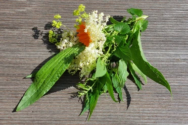
Kräuterbaude Saupsdorf - on the website of the Kräuterbaude you will also find further information about the Friendship Trail, the operator of the Kräuterbaude is a national park guide and also offers guided hikes on the Friendship Trail
Thorwaldblick campsite in Hinterhermsdorf
Wellness hotel Zámeček in Rynartice
Former sanatorium in Jetřichovice (page only in Czech, use the browser's translation function!)
The national parks
Saxon Switzerland National Park
Bohemian Switzerland National Park
The boat trip in the Kirnitzschklamm gorge takes place daily from 9:30 a.m. to 4:30 p.m. from Easter to October 31. The last boat trip starts at 4 pm.
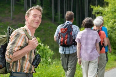
Author´s Tip / Recommendation of the author
Safety guidelines
On the German side outside the national park, the route follows the "Panoramaweg" marked with the yellow dot throughout.
There are two paths to Hermannseck, one easy via normal steps and one narrow on narrow metal steps through a narrow crevice. If you have a lot of luggage, you should be careful here and take the easier ascent.
Map
Nearby


Download GPX file