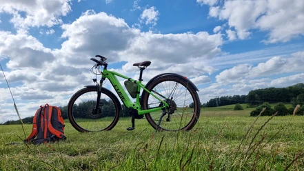
From Amtshainersdorf via the Tanzplan to the Urzeitpark in Sebnitz


- 5:15 h
- 15.86 km
- 480 m
- 420 m
- 248 m
- 594 m
- 346 m
- Start: Amtshainersdorf station
- Destination: Sebnitz station
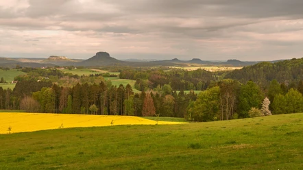
The route leads from Amtshainersdorf through the Sebnitz Valley via the Panorama Trail to the Tanzplan (Tanečnice) - a mountain with an observation tower in the Bohemian Switzerland, from where you can view the entire Elbe Sandstone Mountains. From the Tanzplan, it continues through the Sebnitz Forest to the Urzeitpark in Sebnitz.

Good to know
Best to visit
Directions
The route starts at the Amtshainersdorf stop and initially follows the red dot along the Sebnitz and alongside it until a signpost with a yellow line points right to Hochbusch, Knechtsbachtal, and Kuhstall. At first, it goes through a residential area uphill and then along a country road until leaving the village and entering the forest again.
At the next larger crossroads, follow the yellow dot to the left on the Panorama Trail above Sebnitz along the Alte Hohe Straße to Tomasov (Thomasdorf).
Shortly after Tomasov, follow the blue line to the left up to the Tanzplan (Tanečnice). From the Tanzplan, follow the yellow line again over the border crossing and through Mannsgraben to the Mannsgraben hut.
From the Mannsgraben hut, continue to the right following the yellow dot through the Sebnitz Forest until a signpost points right to the Urzeitpark.
After visiting the Urzeitpark, walk along the road named Forstweg to the Sebnitz and then left along the road into the town. Here too, follow the yellow dot to the National Park Station Sebnitz, where the route ends.
Optionally, at the border crossing after the Tanzplan, the route can also be ended via the Ilse-ohne-Sorge-Weg and Kaiserberg to Sebnitz. This way you pass by KIEZ and the market square of Sebnitz.
Tour information
Stop at an Inn
Directions & Parking facilities
You can drive by car to the National Park Station Bad Schandau, park there, and then take the National Park Train U28.
For the journey there, it is recommended to take the National Park Train U28 from Bad Schandau towards Rumburk to the Amtshainersdorf stop. (In Bad Schandau, you can conveniently change from the S-Bahn S1 to the National Park Train U28.)
VVO connection information to Amtshainersdorf
National Park Train U28 timetable: https://www.vvo-online.de/de/tarif-tickets/tarif/Nationalparkbahn.cshtml
For the return journey, it is recommended to take the National Park Train U28 back from Sebnitz towards Decin to Bad Schandau.
VVO connection information: https://www.vvo-online.de/de/fahrplan/fahrplanauskunft
Author´s Tip / Recommendation of the author
It is advisable to wear sturdy footwear and bring enough provisions, as some paths are unpaved and it is always good to have something to eat and drink with you. Furthermore, stopping at the Waldhaus or/and at the Tanzplan is worthwhile.
With binoculars, you can enjoy the view from the Tanzplan (Tanečnice) even more. There is an entrance fee for the observation tower on the Tanzplan and for the Urzeitpark - but it is worth it.
Nearby


