From Mikulasovíce via the Tanzplan to the Urzeitpark


- 3:00 h
- 8.36 km
- 200 m
- 298 m
- 297 m
- 595 m
- 298 m
- Start: Mikulasovice stred station
- Destination: Dolní Poustevna station
Mikulasovice stred station - Tomasov - Tanzplan (Tanecnice) - towards Sebnitz - Mannsgraben hut - Urzeitpark - Forstweg - Dolní Poustevna - Dolní Poustevna station

Good to know
Best to visit
Directions
The route starts at Mikulasovice stred station and initially follows the road (marked with a blue line) over the railway tracks to Tomasov.
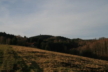
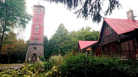
Shortly before Tomasov, turn right and continue following the blue line to the Tanzplan (Tanecnice).
From the Tanzplan, continue following the yellow line towards Sebnitz. Along the way, you cross the border, hike through the Mannsgraben, and reach the Mannsgraben hut.
From the Mannsgraben hut, continue right following the yellow dot to a junction where the Urzeitpark is signposted. Follow these signs to the Urzeitpark, a visit worth it not only for children.
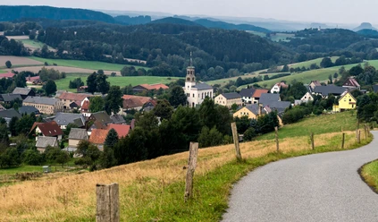
From the Urzeitpark in Sebnitz, descend the road called Forstweg towards Sebnitz, then turn right and continue across the border from Sebnitz to Dolní Poustevna.
In Dolní Poustevna, keep left along the main road to reach the station where the route ends.
GPS data updated 2019
Tour information
Stop at an Inn
Equipment
Sturdy footwear and some provisions
Directions & Parking facilities
Schandauer Str. (172) via S169 to National Park station Bad Schandau
Parking at National Park station Bad Schandau
Additional information
Tourist information Sebnitz: 03597170960
Literature
Order now: Hiking guides
Author´s Tip / Recommendation of the author
Admission is charged for visiting the lookout tower at the Tanzplan and the Urzeitpark. A visit is recommended, especially the mineral exhibition at the Urzeitpark is very interesting.
With binoculars, you can enjoy the outstanding view from the Tanzplan even better!
Safety guidelines
Map
Buy here: Hiking maps
Nearby


