On the E3 through Saxon Switzerland - Stage 2: From Augustusberg to Bielatal


- 5:10 h
- 19.25 km
- 336 m
- 536 m
- 297 m
- 508 m
- 211 m
- Start: Augustus Hill
- Destination: Bielatal
Augustusberg - Markersbach - Moorteich - Ottomühle - Herkulessäulen - Schweizermühle - Sachsenstein - Raum - Panormahöhe - Bielatal

Good to know
Pavements
Best to visit
Directions
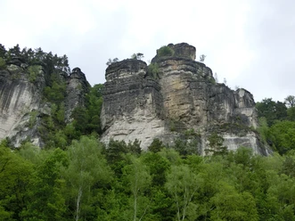
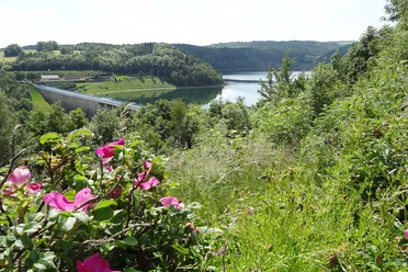
From Augustusberg, the trail descends through forest and meadows to Markersbach. We keep left and walk along the Bahra stream to the junction with Rosenthaler Straße. There we turn right, but are only on this road for a short time, as we leave it again directly at the next crossroads and turn right again (dead end "Buchenhain"). We cross the district of Buchenhain and reach a forest path again. In the forest, we turn right onto the Schwert-A-Weg. This leads us in the direction of Rosenthal, first over the Hirschstange past the moor pond (nice resting place). Immediately after the moor pond, we turn left onto the Mehlsteig and then right at a T-junction onto a narrow forest path that takes us down to the Theilemannweg. We follow this to the left into the district of Ottomühle. In the village, we follow the hiking signs in the direction of Schweizermühle, which leads us through the exciting rocky area around the Hercules Columns. There are several detours here to enjoy beautiful views of the climbing area.
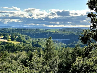
Once we reach the Schweizermühle district, we turn left after the parking lot and walk partly up the stairs towards the room and labyrinth. Shortly after the ascent, we pass the neighbor, which also offers an interesting view. At the next major junction, you can take a detour to the Sachsenstein (green dot), where a steep, narrow ladder takes you to lofty heights with another great view. Otherwise, we turn right at the crossroads, following the signs to Raum and Labyrinth. We pass the Kamphütte and soon reach the road to Raum. We follow this road, pass the town sign after a short while and take the road opposite at the crossroads, which turns off to the right. The signpost in the middle of the crossroads shows us the way to the labyrinth. We take the left-hand bend in the road, but leave it soon afterwards and follow the path branching off to the right. At the next crossroads, we keep right and soon reach the Panoramahöhe. Here we turn off with the "green dot" to Bielatal to spend the night in the village.
Tour information
Cultural Interesting
Equipment
Directions & Parking facilities
Bus stop Bad Gottleuba OT Augustusberg
Bus lines 219 and 247
Departure:
Bus stop Bielatal Reichstein
Bus lines: 245, 242, 247
More information and timetable at https://www.vvo-mobil.de/
Additional information
Thanks to good public transport connections in the area and a well-branched network of marked hiking trails, the route can be varied or shortened in many places.
Author´s Tip / Recommendation of the author
Safety guidelines
Nearby