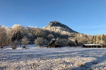
Königstein: From the town to the fortress

- 2:00 h
- 6.44 km
- 202 m
- 204 m
- 115 m
- 308 m
- 193 m
- Start: Bus stop Königstein Reißiger Platz
- Destination: Bus stop Königstein Reißiger Platz
Bus stop Königstein Reißiger Platz - Tourist-Info - Marienkirche - Latzweg - Fortress Königstein - Kanonenweg - Elbhäuserweg - Elbe - Bus stop Königstein Reißiger Platz

Good to know
Pavements
Best to visit
Directions
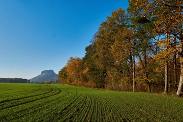
Shortly before a fountain, turn left at the corner of a house and follow the ascending Latzweg to the foot of Königstein Fortress. This historic stairway used to be part of the lower patrol path.
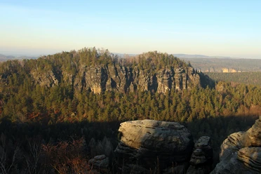
Passing the elevators of Königstein Fortress, which were built in the 1970s as a modern entrance to the fortress, the path on the west side runs along the imposing fortification walls and ramparts. The complex is one of the largest mountain fortresses in Europe: the plateau covers around nine hectares, the walls are up to 42 meters high and the ramparts stretch for almost two kilometers.
The path continues to the old fortress road. Keep left there and follow the Malerweg, which leads under the main road.
You leave the Malerweg on the Kanonenweg. The sandstone path, whose origins lie in a military context, connects the fortress with the Elbhäuser.
Downhill you reach the Elbhäuserweg. Several listed houses from around 1900 are lined up along the slope. Finally, you descend to the Elbe and follow the course of the river upstream back to the starting point at Reißiger Platz.
Tour information
Cultural Interesting
Loop Road
Stop at an Inn
Equipment
- Onion-skin clothing and winter hiking boots
- Backpack with hiking map, snacks, thermos flask with a warm drink, smartphone, flashlight, first aid kit
- Hiking poles, ice goggles
Directions & Parking facilities
Bus routes: 241, 242, 244, 246, 244a and
Bus stop Königstein Reißiger Platz
S-Bahn line S1
Königstein station
More information and timetable: https://www.vvo-mobil.de/
Author´s Tip / Recommendation of the author
Safety guidelines
Map
Nearby


Download GPX file