Pfaffendorf: To the Pfaffenstein table mountain


- 2:20 h
- 6.11 km
- 320 m
- 320 m
- 245 m
- 417 m
- 172 m
- Start: Bus stop Pfaffendorf Vereinshaus
- Destination: Bus stop Pfaffendorf Vereinshaus
Bus stop Pfaffendorf Vereinshaus - Nadelöhr - Berggasthof - Barbarine - Oberer Kohlweg - Sportplatz - Querweg - Bus stop Pfaffendorf Vereinshaus

Good to know
Pavements
Best to visit
Directions
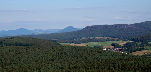
Once at the top of the Pfaffenstein, there are various views, first to the left and then turning back to the right. The trail continues up the table mountain past a mountain inn and the 28-metre-high stone observation tower. The tower was built in 1904 by five men and one woman in just a few months.
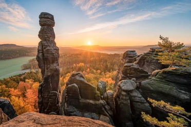
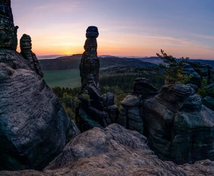
A detour to the southern tip of the Pfaffenstein is worthwhile - the Barbarine, a freestanding rock needle, is one of the most famous natural monuments in Saxon Switzerland.
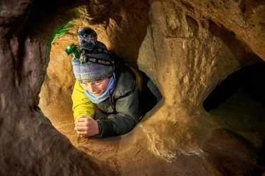
The descent of this tour is via the so-called Bequemer Weg. Then follow the Oberer Kohlweg to the south-east corner of the Quirl. Here you have the opportunity to make short detours - either to the viewpoint via the Kanonenweg or to the Diebskeller cave.
The path continues past a garden colony and the sports field. At a fork in the path, turn right onto the Querweg and finally return to the starting point at the Pfaffendorf Vereinshaus bus stop.
Tour information
Loop Road
Stop at an Inn
Summit
Equipment
- Onion-skin clothing and winter hiking boots
- Backpack with hiking map, snacks, thermos flask with a warm drink, smartphone, flashlight, first aid kit
- Hiking poles, ice goggles
Directions & Parking facilities
Bus route 244a and 243
Further information and timetable information at: https://www.vvo-mobil.de/
Author´s Tip / Recommendation of the author
As an alternative to the eye of the needle, the easier gorge path can also be used as an ascent.
Safety guidelines
The hiking trails are not cleared of ice and snow. Please refrain from the winter hike in icy conditions.
Map
Nearby


Download GPX file