From Sebnitz via Wölmsdorf to the Tanzplan


- 4:57 h
- 16.01 km
- 457 m
- 457 m
- 274 m
- 594 m
- 320 m
- Start: National Park Station Sebnitz
- Destination: National Park Station Sebnitz
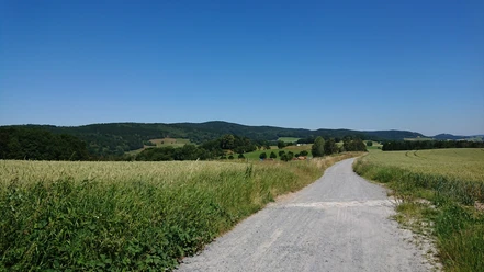
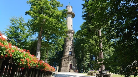
The hike runs mostly over wide forest roads through the Sebnitzwald as well as field and forest paths on and over the Tanzplan. The ascents are quite moderate except for the start from Sebnitz, and even the climb to the Tanzplan is long but not steep. Otherwise, the route offers many opportunities to stop and rest as well as a place to eat and drink on the Tanzplan, where you can enjoy reasonably priced and very good food and drinks. The entrance to the observation tower costs less than 1 Euro, and in good weather, you can look over the entire Elbe Sandstone Mountains. Along the way, various interesting spots invite you to marvel and admire – not least the Maria Church in Wölmsdorf and the Maria Fountain.

Good to know
Best to visit
Directions
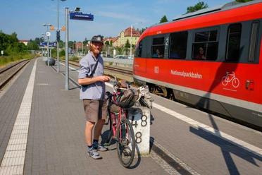
The start and end of the hike is the National Park Station Sebnitz, which can be easily reached from Bad Schandau by the National Park Train (U28). If you are arriving by car, you will find free parking here.
From the National Park Station Sebnitz, head towards the town center through the railway underpass and then immediately turn left onto Kreuzstraße. After about 250 meters, turn right onto Haseleitenweg along the Kräutervitalbad Sebnitz. Then, go a short distance (about 50m) to the left along Böhmische Straße before turning right again onto Weberstraße and at the end of this street, turn left to climb steeply up the upper Rosenberg. Here, it’s worth looking back briefly at Sebnitz.
Then, continue along the path past the allotment garden area "Forellenschänke" to the forest and follow the signpost towards the "Sebnitzer Urzeitpark" into the Sebnitzwald. Walk through the forest along the Kälbersteig (wide forest path) to the Tannenhütte - a distinctive, slightly elevated shelter at a crossroads. If desired, you can take a first short rest here or continue to the next junction, where you keep left and continue along the "Alte Nixdorfer Straße". After about 800 meters, you will find a sign inviting you on a short detour to the Hubertus Chapel.
After the short detour, continue on the Alte Nixdorfer Straße, passing a memorial stone for a Wölmsdorf resident who froze to death. At the next large intersection, keep left and follow the signpost towards Bernigweg and Wolfsstein. Then the path becomes a bit rugged – at least the forest road seems to be more overgrown here until the next signpost directs you towards Wolfsstein. Follow this only for a short distance, then immediately turn left onto Wolfssteinweg, where after about 100 meters you cross-country hike up a inconspicuous forest path to the Wolfsstein (see pictures).
At the Wolfsstein, you can make your first rest at the latest – there is definitely a seating area inviting you to do so. From the Wolfsstein, go back a short distance, then turn left back onto the Alte Wölmsdorfer Straße, which you follow to Vilémov.
Once in Vilémov, you cross the border into the Czech Republic behind a property and follow the village street through the railway underpass, then continue following the blue trail to the Maria Assumption Church. Next to it, under a large tree, is the holy Maria Fountain.
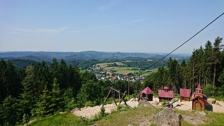
From the church, continue following the blue trail out of Vilémov over a large open field directly onto the Tanzplan. A rocky path and at the end a trail through the forest lead up to it.
On the Tanzplan, you can linger, refresh yourself, and enjoy a spectacular view in good weather before descending again behind the guesthouse on a trail through the forest (see pictures). Follow this until you reach a wide forest road where you turn right and at the next fork follow the yellow trail to the border crossing.
From the border crossing, follow the yellow trail for a short distance (approx. 80 meters) along the Mannsgraben, immediately turn left at the next opportunity, and hike up the Kaiserberg, where you have a small viewpoint called "Spitzbergsicht" overlooking the ski slope. From there, continue following the yellow dot along the "Ilse without Worries Path" towards "KiEZ" downhill to the Buchberg viewpoint, which is located directly below the KiEZ "An der Grenzbaude". Finally, follow the blue trail through Sebnitz to the beautiful marketplace and from there back to the station.
Tour information
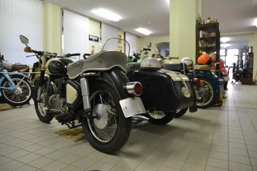
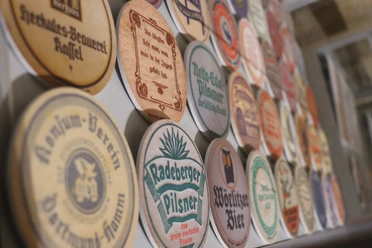
Cultural Interesting
Loop Road
Stop at an Inn
Equipment
Sturdy mid-cut hiking boots are recommended!
Directions & Parking facilities
It is recommended to travel to and from with the National Park Train U28 from Bad Schandau to Rumburk -
You can find the current timetable here: https://www.vvo-online.de/de/tarif-tickets/tarif/Nationalparkbahn.cshtml
Additional information
The Maria Church is closed, and you can only catch a glimpse of it through a small window in the door.
However, if you wish to visit it more thoroughly, you can arrange this in advance with Jacek Kotisz at +420 713 402 565 or Petra Petrášová via email at petraludmila@gmail.com.
Author´s Tip / Recommendation of the author
A very worthwhile hike, where you shouldn't forget your binoculars. The food on the Tanzplan is really delicious. For children, it is recommended to bring hiking poles to promote endurance and motivation!
Nearby

Download GPX file