Forststeig - Stage 1: From Schöna to Grenzbaude


- 6:00 h
- 15.81 km
- 712 m
- 414 m
- 125 m
- 548 m
- 423 m
- Start: Schöna train station
- Destination: Trekking hut Grenzbaude
In April 2018, Sachsenforst and Lesy České republiky opened the trekking route that had been planned for 5 years. As the forestry administrations of the Free State of Saxony and the Czech Republic, we want to bring people closer to nature with the "Elbe Sandstone Forest Trail" project.
The trekking route allows visitors to hike for several days between April and October through the forests on the border between the Federal Republic of Germany and the Czech Republic. Along the way, it is possible to spend the night in trekking huts and at bivouac sites run by Sachsenforst and tourist partners. On the Czech side, there is a public campsite directly on the route.
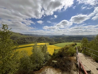
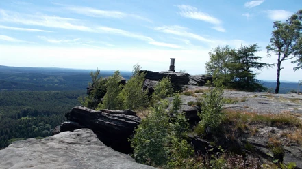
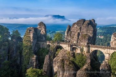
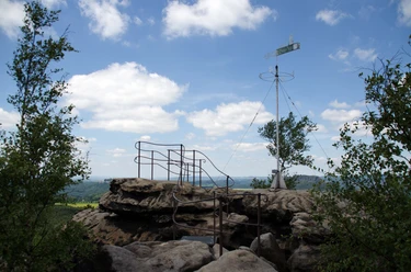
The Elbe Sandstone Forest Trail is a challenging trekking route for experienced, sure-footed and well-equipped hikers. On the left bank of the Elbe, it leads mostly on easy forest paths and trails as well as forestry work roads over 100 km in 7 stages through the unique landscapes of Saxon-Bohemian Switzerland, which is known for its extensive contiguous forests, bizarre rock formations and mighty table mountains.

Good to know
Best to visit
Directions
Equipment
1 Get the right information
Inform yourself thoroughly about the route, news, the upcoming weather and the instructions on how to behave on the Forststeig, in the huts and at the bivouac sites.
2 Assess yourself realistically
Think about how fit you are. Plan the stages so that you arrive at your destination in time for daylight. You can find a division into 7 stages under route overviews.
3 Plan suitable overnight stays
Plan your overnight stays and think about alternatives. Note that camping in the forest and at the trekking huts is prohibited. Take advantage of the offers of the Forststeig partners.
4 Your safety
Always walk at least in pairs and tell someone about your plans in advance. Remember your first aid kit.
5 Pay attention to the weather
The weather is an important factor. Check the forecasts. Avoid the forest in bad weather and storms. Be aware of the risk of forest fires.
6 Be well equipped
Take enough food, drinking water and the right clothing and equipment with you. Remember that cooking and lighting with an open flame is only permitted at official fireplaces and in the huts. Fill up your water supply whenever possible. We recommend taking good topographical hiking maps (with springs and watercourses marked) and suitable equipment for water treatment.
7 Forestry work and dangers
The forest trail leads through near-natural areas and managed forests. Walk on it at your own risk. Observe closures and notices.
8 Do not forget: Trekking tickets
You need trekking tickets if you want to stay overnight in a trekking hut or at a bivouac site. The proceeds from the sale of the tickets are used to support and maintain the forest trail.
Additional information
Author´s Tip / Recommendation of the author
Safety guidelines
Observe the Forststeig code of conduct
✔ Do not light fires in the forest!
✔ Do not smoke in the forest!
✔ Only cook at the cooking areas!
✔ Only spend the night in the forest in the trekking huts and on the bivouac sites!
✔ Don't make any noise in the forest!
✔ Don't leave any garbage behind!
✔ Don't hike at dusk or at night!
✔ Stay on the path!
✔ Validate the trekking tickets on arrival at the overnight accommodation.
Map
Nearby
