Circular hike with René-Prokoph-Weg


- 3:20 h
- 9.00 km
- 248 m
- 253 m
- 120 m
- 372 m
- 252 m
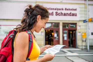
- Start: National Park train station Bad Schandau
- Destination: National Park train station Bad Schandau
Bad Schandau station - René-Prokoph-Weg - Rietschgrund - Hörnelweg - historic Kammweg - Anna's Ruh viewpoint - historic Kammweg - Großer Spitzhübel - Gohrisch Forest Cemetery - Königsteiner Steig (yellow) - Höllenweg - Kleinhennersdorfer Stein - Lichterhöhle - Malerweg (red mark) - Täppichtsteig - Elbe cycle path - Bad Schandau station

Good to know
Pavements
Best to visit
Directions
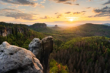
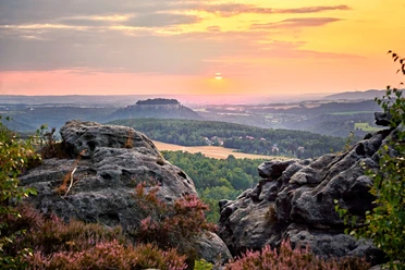
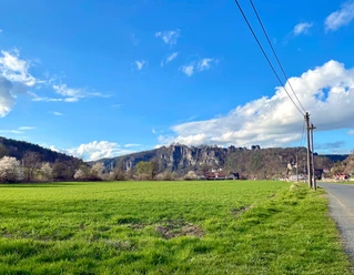
At the National Park train station Bad Schandau, start by going up to the bridge and then a short way to the left along the B172 until the striking steel staircase appears, which leads to the newly created René-Prokoph-Weg. From here, continue a short distance to Schandauer Straße. You need to cross this street and then follow the Hörnelweg to Gohrisch up to the Anna's Ruh viewpoint. This is the most strenuous part of the hike, as there are quite a few elevation meters to overcome. At the Anna's Ruh viewpoint, you can take a short break to enjoy the view of Bad Schandau, the Elbe, and the impressive railway bridge, recovering from the ascent. Next, continue along the historic Kammweg (path, yellow). Note about the Kammweg: Please note that the path is currently still quite narrow and overgrown and is only suitable for hikers with good surefootedness who use a detailed hiking map or app. Along the narrow path are historic boundary stones, sometimes hidden, sometimes quite obvious. An old cemetery cross from 1866 also suddenly appears in the green, among the ferns. At the "Spitzer Hübel," a newly built bench invites you to rest. Continue past the Gohrisch forest cemetery to the fork to Gohrisch or Kleinhennersdorf. If you are hungry, walk a little further into the village center and stop at the restaurant Cucina in Quartier 5 in Gohrisch. Refreshed, continue over the Königsteiner Steig (yellow) toward Kleinhennersdorf. At the junction, take the "Höllenweg" to the Kleinhennersdorfer Stein and the mystical "Lichterhöhle." The "Eishöhle" and the "Hampelhöhle" are also to be discovered. They are somewhat hidden, so it may happen that you do not find them immediately. Then descend via some stairs to part of the 6th stage of the Malerweg (red mark) continuing towards Kleinhennersdorf. Via the Täppichtsteig, descend to the Elbe to reach the Elbe cycle path. Along there, enjoy the view of the town of Bad Schandau. Maybe a historic steamship will just be starting with typical puffing and tooting before the circular hike ends back at the National Park train station.
Tour information
Cultural Interesting
Equipment
Directions & Parking facilities
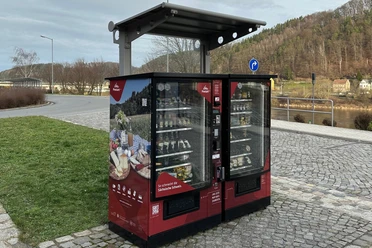
From all directions, via the B172 to the P+R Bad Schandau National Park train station.
P+R Bad Schandau National Park train station
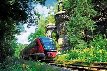
Arrival and departure:
For example, S-Bahn line S1 to Bad Schandau National Park train station
Many other bus lines from the region arrive at the bus station.
Additional information
René Prokoph (1967 – 2014) was a passionate preserver of the Saxon Switzerland and chairman of the Gohrisch local heritage association. Unfortunately, he died much too early as a result of a work accident. His great interest included cultural history, monument and nature conservation, and practical species protection in Saxon Switzerland.
Literature
Order now: Hiking guides
Author´s Tip / Recommendation of the author
Tip: If you like good food, you should definitely stop at the restaurant Cucina in Quartier 5 in Gohrisch.
Safety guidelines
The historic Kammweg (narrow path) is currently only partially accessible. Surefootedness and a hiking map/app are essential to avoid getting lost.
Map
Nearby

