Nature experience hike between Zeisigstein and Hartenstein


- 3:00 h
- 10.00 km
- 117 m
- 117 m
- 439 m
- 547 m
- 108 m
- Start: Markersbach bus stop "Gasthaus zur Linde" or Markersbach hiking car park
- Destination: Markersbach bus stop "Gasthaus zur Linde" Markersbach hiking car park
Markersbach hiking car park - Buchenhain forest nature trail - Kochemoor - Zeisigstein - Hartenstein - Markersbach hiking car park

Good to know
Pavements
Best to visit
Directions
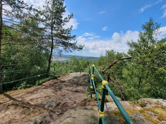
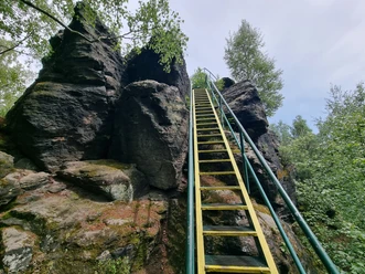
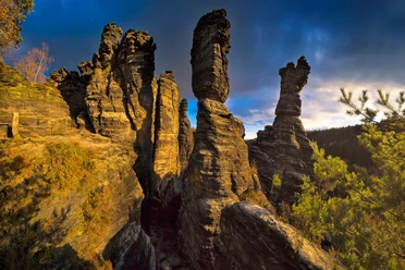
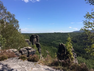
From the starting point, you can follow the newly created Buchenhain forest nature trail (unmarked) and learn a few educational things. Then continue along a wide forest road to the Kochemoor protected natural area. After that, follow the forest trail marking towards Zeisigstein. Zeisigstein, at 551m, is the third highest elevation in Saxon Switzerland. After a rest at Zeisigstein, continue along the forest trail to the second viewpoint: Hartenstein. You reach this via an iron bridge. From there, it goes back to the Markersbach hiking car park or the bus stop.
Tour information
Cultural Interesting
Loop Road
Equipment
Directions & Parking facilities
Via Königstein, Langhennersdorf to Bahra.
Markersbach hiking car park (approx. 20 cars).
Arrival and Departure:
Bus line 247 (Mon-Fri) or 218 (Mon-Fri)
Stop: Markersbach "Gasthaus zur Linde"
On weekdays, it is advisable to arrive by bus 242 or 218 and get off/on at the Markersbach "Gasthaus zur Linde" stop.
On weekends, the car is the best choice with the starting point at the Markersbach hiking car park.
Additional information
Author´s Tip / Recommendation of the author
The hike is especially recommended in spring.
Safety guidelines
CURRENT [April 2025]: Closure in the Kochemoor area until May 16, 2025. A detour recommendation can be found here.
In winter, forestry work and hunting may take place here. Please observe the on-site instructions.
Nearby
Download GPX file