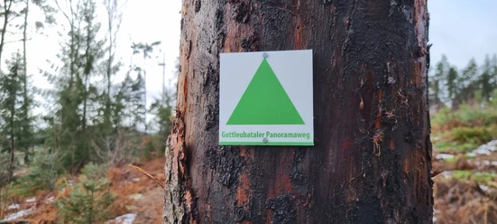
Augustusberg, ridge trail through the Tannenbusch and more around Bad Gottleuba


- 2:55 h
- 9.34 km
- 254 m
- 257 m
- 337 m
- 511 m
- 174 m
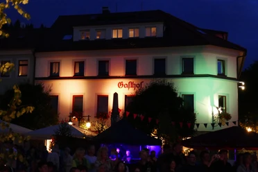
- Start: Marketplace in Bad Gottleuba
- Destination: Marketplace in Bad Gottleuba

Good to know
Best to visit
Directions
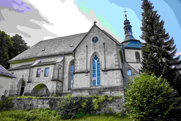
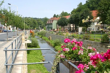
From the marketplace, we hike steeply up Kirchgasse, past very old houses, St. Peter's Church, and the old cemetery. We follow the circular trail no. 5 (yellow "G" on white background with the corresponding route number) and come onto the 14-Saints Path. This paved residential street leads to a hill with a wonderful view over the town and the spa park.
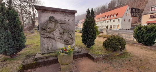
Soon we reach the penitential cross. This stone cross is said to commemorate the events of 1430: According to legend, Hussites advanced on Gottleuba at that time. The mayor and 13 young men held off the attackers long enough for the residents to take refuge in the forests. They themselves lost their lives in the process.
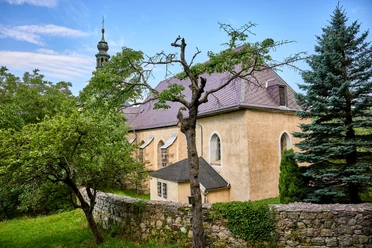
We follow the hollow way to the left, cross the street (after about 100 meters another street crossing), and continue straight on the hiking trail past a seating area through meadows and fields. At the first houses, the path to Augustusberg is signposted. Passing the lattice radio mast, we arrive after another 150 meters at the road leading to Augustusberg. Past the mountain hotel, we climb a few steps to the viewpoint. From here, you can see the Gottleuba dam, built from 1964 to 1974, and also look into the Eastern Ore Mountains towards Kahleberg, Geising, and Luchberg. Geologically, Augustusberg is a sandstone island in the middle of granite. Previously, there was a lookout tower here, which collapsed in 1891 after only 11 years due to a storm. A second tower lasted much longer but was demolished after World War II due to dilapidation.
Back again, we follow the markings "yellow dot" and G5. At Kurvenstraße, we pass directly by the bus stop "Rodelbahn." However, we want to hike further and go left along Kurvenstraße. Arriving at Hohe Straße, we cross it. Here begins a wide, comfortable forest path. We now follow the signposts for circular trail no. 10, go straight over the timber storage area, and take the next left at a fork.
On Obere Hüttenleite, we reach the forest area in a gentle curve. A signpost indicates a viewpoint about 30 meters down. On a narrow path, you reach Franz-Schönbach View. A bench invites you to linger. Back on the wide hiking trail, after 20 meters, we turn right from Obere Hüttenleite. At this point, there is a signpost "Augustusberg." On a beautiful forest path, we reach Hohe Straße, cross it again, and walk to the bus stop "Rodelbahn."
Now we turn onto the paved forest path "Rodelbahn." About one kilometer downhill comfortably, we pass the "Hennigbrunnen," which springs at the very end of the "Rodelbahn." This steep forest path was developed into the city’s toboggan run in 1908. In winter, hearty sled rides are guaranteed!
Now we follow Hellendorfer Straße downhill until just before the cemetery, where we turn left and hike up to Tannenbusch. Up a steep iron staircase to a viewpoint and the ridge trail. The ridge trail is a narrow hiking path offering a wonderful view.
The rock tourmaline granite forms the jagged ridge of the Tannenbusch. The 3 km long and 1 km wide ridge extends from Tannenberg over Helleberg to Raabstein. Previously, there was a quarry here where tourmaline granite was mined.
The last part of the ridge trail leads down stairs again to circular trail no. 8. However, we continue descending to Talstraße, cross the Gottleuba, and walk along the Gottleuba and via the Mühlensteig back to the village center.
Tour information
Cultural Interesting
Loop Road
Summit
Tour with Dog
Directions & Parking facilities
From Pirna take bus 216/219 towards Bahratal to the stop Hackebeilstraße/Berggießhübel
(vvo-online.de)
Additional information
Here you will find everything about hiking in the Elbe Sandstone Mountains.
All our hiking routes with free GPX download can be found directly on our website.
Author´s Tip / Recommendation of the author
The route is suitable for older, active children and also for dogs.
Nearby


Download GPX file