Through the wintry Bielatal to the Grenzplatte

- 2:33 h
- 8.89 km
- 172 m
- 172 m
- 364 m
- 531 m
- 167 m
- Start: Ottomühle car park
- Destination: Ottomühle car park

Good to know
Pavements
Best to visit
Directions
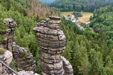
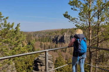
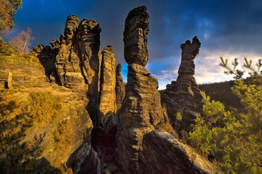
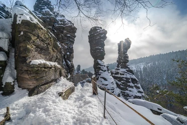
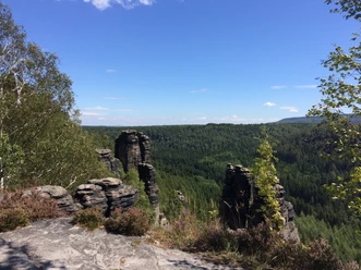
The route starts at the car park in front of the Ottomühle in the Bielatal. Along the road, the path leads past the Ottomühle to the junction towards Grenzplatte (watch the path marking "Red Line"). If there is snow and ice, the following ascent over steps must be taken with caution. The further path leads over a forest road to the junction to the Grenzplatte. From the plateau of Grenzplatte, there is a beautiful view of the rock pinnacles of the Bielatal and towards Ostrov in Bohemian Switzerland.
The return route initially follows a forest path, then branches onto a well-developed forest road that leads downhill all the way back to the Ottomühle.
Tour information
Loop Road
Directions & Parking facilities
From Pirna: via B172 - after the village of Krietzschwitz turn right towards Rosenthal-Bielatal ...
From Bad Schandau: via B172 in Königstein at the roundabout turn towards Rosenthal-Bielatal ...
... in Rosenthal-Bielatal towards Schweizermühle - at Schweizermühle turn right to Ottomühle
Ottomühle car park - charged
Arrival/Departure:
- by the S-Bahn S1 to Königstein
- from there by Bus line 242 to the stop "Mühlstein/ Rosenthal"
Additional information
www.saechsische-schweiz.de
Safety guidelines
In winter the hiking trails are not cleared of snow and ice. Use at your own risk.
Please note: in the Saxon Switzerland National Park, only marked paths may be used in the core zone.
Fines may be imposed for violations.
Nearby

Download GPX file