- 1:50 h
- 5.16 km
- 215 m
- 215 m
- 160 m
- 329 m
- 169 m
- Start: Hiking parking lot in the Kirnitzsch Valley near the Lichtenhainer Mühle (not at the Lichtenhainer Waterfall!)
- Destination: Hiking parking lot in the Kirnitzsch Valley near the Lichtenhainer Mühle
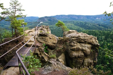
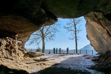
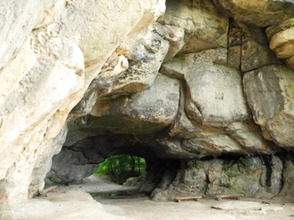
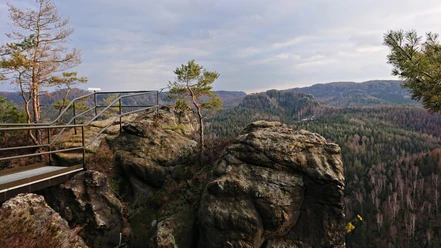
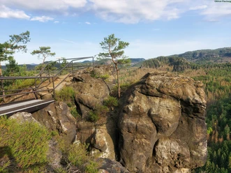
By means of a constant ascent, you reach the mighty "Kuhstall", the second largest rock gate of Saxon Switzerland. During the Thirty Years' War, livestock was hidden here from Swedish soldiers, giving the rock gate its name. A short detour towards Schneiderloch and "Krumme Caroline" is worth it to enjoy the beautiful view. Both destinations themselves, however, are not accessible to wheelchair riders.

Pavements
- Street (30%)Gravel (60%)Path (10%)
Best to visit
- suitableDepends on weather
Directions
From the hiking parking lot in the Kirnitzsch Valley, we walk almost level at first on the "Alte Straße" (Old Street), but the path steepens already after 200 m. The following section of about 100 m is paved but also the steepest part of the ascent. After that, it becomes slightly flatter before the slope increases again for another 200 m at a second incline – this time on fine, compacted gravel. Still very steep, we continue climbing uphill until, after what feels like an eternity, the terrain finally levels off. The most strenuous part of the ascent is now done, and the last stretch to the Kuhstall Cave is even level.
From the Kuhstall Cave or the guesthouse, a short detour to the Schneiderloch or the "Krumme Karoline" is recommended, though both are not wheelchair accessible.
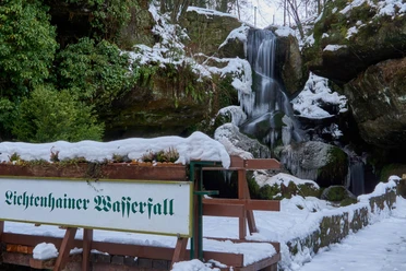
The descent via the "Kuhstallstraße" (as shown on the map) should only be tackled by those who have sufficient personal support, as this hiking trail is very steep and rocky. (Otherwise, return the way you came!) It remains difficult for at least 800 m until the junction where the hiking trail branches off via steps to the Lichtenhainer Waterfall. We now keep to the right and follow the path running parallel to the slope, which eventually brings us back to the Kirnitzsch Valley. The last part of the route follows the Kirnitzschtalstraße back to the starting point.
Tour information
Cultural Interesting
Loop Road
Stop at an Inn
Suitable for Pushchair
Tour with Dog
Directions & Parking facilities
- Getting there
Option 1: A13 or A4 to Dresden-West motorway junction > A17 towards Prague > Pirna exit > B172 towards Bad Schandau > in Bad Schandau finally the Kirnitzschtalstraße towards Hinterhermsdorf up to the "Lichtenhainer Waterfall".
Option 2: A13 or A4 to Burkau exit > via Bischofswerda and Neustadt to Sebnitz > finally from Sebnitz via Ottendorf or Saupsdorf into the Kirnitzsch Valley (direction Hinterhermsdorf) and turn right there towards Bad Schandau up to the "Felsenmühle".
ParkingHiking parking lot at Lichtenhainer Mühle
Public transportationTake the train to Dresden main station and continue via S-Bahn S1 to Bad Schandau (some IC trains – from Hamburg/Berlin – go directly to Bad Schandau). Regional bus 241 towards Hinterhermsdorf takes you directly from Bad Schandau station to the stop "Lichtenhainer Mühle".
Additional information
Access to the Kuhstall Cave is only possible via the left path over a now somewhat washed-out ramp, the direct path from the guesthouse leads over two steps. The sandstone peak of the Neuen Wildenstein above the breakthrough cave is not barrier-free accessible due to many steps (via the "Himmelsleiter" and the alternative ascent near the "Schneiderloch").
During the route, there are no disabled toilets, not even in the guesthouse on the Neuen Wildenstein.
Author´s Tip / Recommendation of the author
On the sandstone at the upper cave boundary on the viewpoint side, old inscriptions of former "Switzerland travelers" can be seen.
Safety guidelines
This route is not suitable for passive wheelchair users (i.e., people who are pushed exclusively by companions without their own activity)!
Moreover, (pushing) assistance by companions without disability is strongly recommended, as slopes of up to temporarily 20% must be managed on the approach. On the steepest kilometer of the ascent, the average gradient is 11.5%. Hiking with an e-wheelchair is possible as long as it can technically handle the mentioned slopes on slightly gravelly ground.
The easiest way back is on the same route – the downhill path from the Neuen Wildenstein shown on the map should otherwise also not be used without extensive help due to the path condition and initially very steep terrain (danger of tipping over in the wheelchair)!