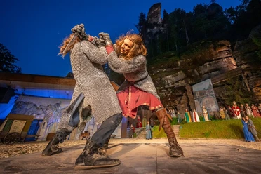
Short route over the Rauenstein


- 1:40 h
- 4.91 km
- 200 m
- 203 m
- 116 m
- 286 m
- 170 m
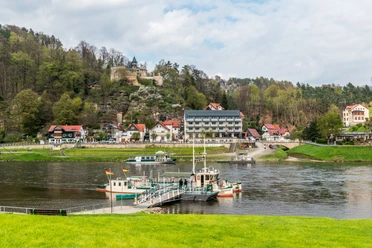
- Start: Oberrathen ferry point
- Destination: Oberrathen ferry point

Good to know
Pavements
Best to visit
Directions
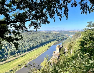
From the ferry point in Rathen, the path first leads towards Elbweg street. Follow this over the railway crossing until a left turn marked "red stripe" occurs. This is the Rauenstein path, which you then follow up to the ascent to the Rauenstein. On this stretch you pass, for example, the Laasenstein. From the fork to the ascent to the Rauenstein, the path continues parallel to the Malerweg. Once at the top, a detour to the viewpoint on the left side is definitely worthwhile. There is also the Rauenstein rock inn. Immediately behind it you reach a wonderful viewpoint. After this detour, follow the Malerweg signposts over the ridge trail of the Rauenstein. This leads once over the entire, almost one-kilometer-long mountain ridge, accompanied by a magnificent 360-degree panorama of rocks, table mountains, Elbe valley, forests, fields, and villages. Afterwards, after the descent, follow the path to the right back down again to Oberrathen.
Tour information
Loop Road
Directions & Parking facilities
B 172 to Pirna-Sonnenstein, shortly after Sonnenstein turn left towards Rathen
Navigation input: Elbweg 10, Kurort Rathen
Parking lot Oberrathen
Arrival/Departure:
S-Bahn line S1 to Kurort Rathen
Author´s Tip / Recommendation of the author
Proviantomat in Rathen
Nearby


Download GPX file