From Kurort Rathen via the Lilienstein and Prossen to Bad Schandau


- 4:00 h
- 11.81 km
- 360 m
- 351 m
- 114 m
- 409 m
- 295 m
- Start: Kurort Rathen
- Destination: Bad Schandau
It is the landmark of the Saxon Switzerland National Park and an image of a table mountain: the Lilienstein. Climbing this giant is a strenuous but fulfilling hiking adventure. The Lilienstein also fascinated Caspar David Friedrich. As varied as the motifs of the table mountain are, so is this route from Kurort Rathen to Bad Schandau.

Good to know
Pavements
Best to visit
Directions
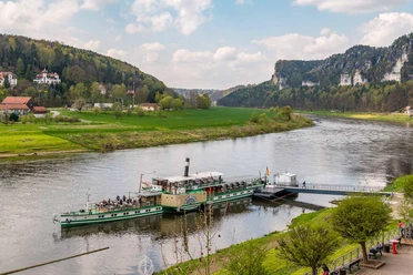
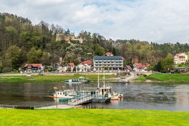
This hike begins in Kurort Rathen on the right bank of the Elbe. Shortly after the ferry dock, follow the path to the right over a small bridge and then continue upstream along the paved footpath towards the Lilienstein, which is already wonderfully in view here. After passing the last houses, you reach the actual hiking trail (blue mark) and pass an information board of the Saxon Switzerland National Park. From here, the path leads comfortably and shaded along the Elbe riverbank. After about 15 minutes, there is a nice rest area with a bench on the right at the height of a log cabin. Here, a look back towards Kurort Rathen and the rocks of the Bastei area is also worthwhile. On the following section of the path, the route branches off to the left after about 10 minutes to the Lottersteig. Here, the path now goes steeply uphill. Once at the top, cross the street and follow the signage further to the Lilienstein (blue marked path). The south ascent is intended for climbing the Lilienstein. Once on top, the path leads across the table mountain and past numerous viewpoints. Shortly after the ascent, a short detour to the left to a first viewpoint is worthwhile. The descent is via the northern descent. Once down, the path continues on the "Yellow mark" towards Prossen. Upon reaching Prossen on the Elbe, one should look back once again to the Lilienstein. This view was also immortalized by Caspar David Friedrich in a drawing. Back on the main street of Prossen, follow the "Yellow mark" further to Bad Schandau. This is followed by a longer section along the road. Shortly after the Bad Schandau bridge, you access the Elbe cycle path again. The route ends at the market square of Bad Schandau.
Tour information
Summit
Directions & Parking facilities
Kurort Rathen: Oberrathen car park
Bad Schandau: Elbkai
Kurort Rathen: S-Bahn S1 | Stop: Kurort Rathen | Station
Bad Schandau: S-Bahn S1 | Stop: Bad Schandau | National Park Station || Bus 241 | Bus 252 | Bus 260 | Stop: Bad Schandau | Elbkai
Nearby


