Goßdorf: scenic route with Robber Castle and wild valleys


- 4:15 h
- 12.71 km
- 400 m
- 400 m
- 164 m
- 398 m
- 234 m
- Start: Goßdorf Bad Car Park
- Destination: Goßdorf Bad Car Park
Goßdorf - Hankehübel - Goßdorf Robber Castle - Sebnitz valley - Auf dem Schirm - Ulbersdorf - Hutberg - Schwarzbach valley - Gickelsberg - Goßdorf

Good to know
Pavements
Best to visit
Directions
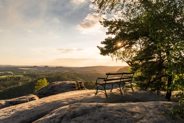
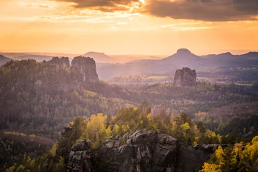
The route starts at the car park of the natural swimming pool in Goßdorf and leads up the mountain road into the village. At Butterlecke, turn left and follow the signs to Hankehübel. From this wonderful viewpoint, the landscape lies at your feet. The cattle path first goes across fields, then along a narrow ridge path through woods and over rocky outcrops to the Goßdorf Robber Castle. Many legends and tales revolve around this place. A picnic area and reconstructed ruins make this spot very special.
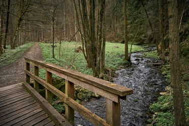
Downstairs via stairs into the Schwarzbach valley and crosses the river on a large stone block carved from one block. Immediately after, turn right into the Sebnitz valley. Right after the railway underpass, the path continues keeping left and runs just below the railway embankment directly along the river.
At the next crossroads, go under the railway tracks and follow the "Green Stripe" marking through hillside forests with magnificent giant trees. At the rest area "Auf dem Schirm", you have another wonderful view of Saxon Switzerland. On a wider path and later on a residential street, you reach Ulbersdorf. Just before the village entrance, a short detour to Hutberg is worthwhile; in the village, to the castle. The "Blue Stripe" marking leads left at the sports field onto the Long Way, which descends into the Schwarzbach valley. Upon arriving at the bottom, continue hiking left through the romantic valley. After a bridge and before a tunnel of the former narrow-gauge railway, the "Blue Stripe" marking turns right. On the so-called Postman's Path, you hike uphill; the last section is part of a geological circular trail. The Gickelsberg, a distinctive basalt cone with rare natural mountain meadows, at 414 m height is the crowning conclusion of the hike. Downhill with wide views of the landscape, the path now leads down past the edge of the village and an exhibition of historic agricultural machinery back to the starting point of our route.
GPS DATA updated 2022
Tour information
Cultural Interesting
Loop Road
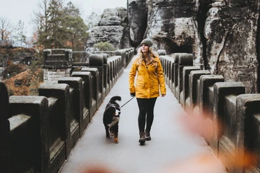
Tour with Dog
Equipment
Hiking shoes, provisions
Directions & Parking facilities
Ideally via the town Hohnstein or the town Sebnitz
Stop Alte Schule Goßdorf
Bus line 235 (Monday to Friday)
Additional information
Literature
Author´s Tip / Recommendation of the author
The route is also suitable for smaller groups. It is recommended to bring hiking provisions, as there are no dining options along the way.
Safety guidelines
Accessible all year round.
However, spikes should be used in sections during icy conditions. Caution is advised during deep snow on the way to Goßdorf Robber Castle.
Map
Order now: Hiking maps
Nearby


Download GPX file