On the way between two rivers: from the Elbe into the Polenz Valley


- 4:05 h
- 12.59 km
- 393 m
- 393 m
- 113 m
- 312 m
- 199 m
- Start: Kurort Rathen
- Destination: Kurort Rathen
S-Bahn stop in Kurort Rathen - Kurort Rathen - Amselsee (green line marking) - Hockstein - Wolf Gorge - Polenz Valley (red dot) - uphill path (red line) - Ziegenrückenstraße - Füllhölzelweg (red line) - Gamrig - Gamrig Cave - Rathen

Good to know
Best to visit
Directions
The starting point is the S-Bahn stop in Kurort Rathen or the parking lot on the left side of the Elbe. After the ferry ride, you go through Kurort Rathen, keep left, and walk along the stream to reach Amselsee. Then turn right and follow the green line marking. After a staircase ascent, keep left and continue following the green marking to Hockstein.
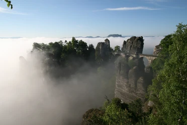
The Hockstein is an exposed rock spur high above the Polenz Valley. Opposite lies Hohnstein Castle. Not far from here is the Lusatian Overthrust – the transition from granite to sandstone. This is clearly visible by the different valley shapes: v-shaped in the granite upstream and u-shaped in the sandstone downstream.
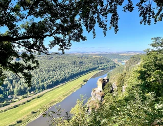
Through the Wolf Gorge, a very narrow rock crevice, it goes deep down into the noticeably cooler Polenz Valley. The Polenz Valley is one of the first areas declared a protected area long before the national park. It is habitat to many rare animal and plant species, such as black stork, dipper, kingfisher, and otter, as well as silver fir and ostrich fern.
After the descent, turn right and hike along the Polenz on the path marked with a red dot. After about 2.5 km, take the uphill path to the right (red line). At the top, cross Ziegenrückenstraße again and hike on the Füllhölzelweg (red line) towards Rathen. Later, you reach a fairly wide, unmarked path branching off to the left. Follow this for a short distance and take the next uphill path to the right. At the next junction, keep left and continue uphill around a curve. After another curve, a signpost shows the ascent to Gamrig. Follow this path and climb steeply to the summit of the table mountain. Descend the same way back to the signpost and then continue to the left.
Shortly before the road, a detour to the Gamrig Cave is possible. For this, take the stairs on the left at the road up (same way back). Otherwise, take the small path directly to the right (Aspichgraben). It leads downhill to Rathen, through the town, and back to the starting point.
Tour information
Loop Road
Directions & Parking facilities
Parking lot on the left bank of the Elbe at the ferry terminal in Kurort Rathen
By S-Bahn to Kurort Rathen
Author´s Tip / Recommendation of the author
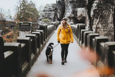
The route is suitable for children. At the Wolf Gorge, numerous metal staircases must be overcome and it gets quite narrow, so the route is only conditionally suitable for dogs.
Nearby


Download GPX file