On the E3 through Saxon Switzerland - Stage 4: From Königstein to Hohnstein


- 6:30 h
- 17.94 km
- 894 m
- 713 m
- 114 m
- 410 m
- 296 m
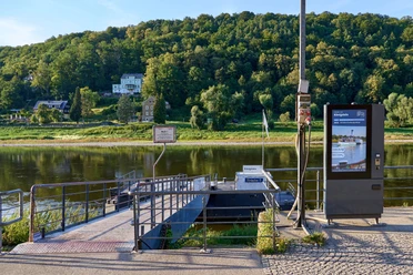
- Start: Königstein, ferry pier
- Destination: Hohnstein
Königstein - Lilienstein - Ebenheit - Kurort Rathen - Bastei - Schwedenlöcher - Rathewalder Mühle - Rathewalde - Hohburkersdorf - Zeschnig - Hockstein - Schindergraben - Hohnstein

Good to know
Pavements
Best to visit
Directions
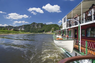
We start with the ferry ride from Königstein to the right bank of the Elbe. There, we first turn right, then immediately left again and continue uphill past the "Luxusboofe" to the Königstein district of Ebenheit. Turning right, a short section of the trail leads leisurely through meadows until the southern ascent up the Lilienstein challenges us again. We are now in the Saxon Switzerland National Park. On the plateau of the Lilienstein, a rock restaurant takes care of the hiker's physical well-being.
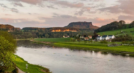
We descend via the northern descent, which takes us back to the foot of the Lilienstein via short sections of ladder. We follow the church path and later keep left onto the Lottersteig trail, which we follow to the Elbe and then on to the spa town of Rathen. In the spa town of Rathen, we follow the signposts to the Bastei. Opposite the Hotel Amselgrundschlösschen, the hiking trail leads uphill to the world-famous Bastei Bridge and the surrounding viewpoints. The Bastei viewpoint offers a wonderful view of the Elbe valley.
We leave the Bastei area and follow the Bastei road to the parking lot. Here we turn right and also keep right at the next major crossroads. Following the Gansweg, we reach the Schwedenlöcher gorge and enter the core zone of the national park. Before descending, we recommend a short detour to the pavilion viewpoint, which shows us the Bastei bridge from a completely different perspective.
Over 600 well-built steps lead us downhill through the Schwedenlöcher. Once we reach Amselgrund, we turn left and follow the path uphill past Amselfall to Rathewalde. We cross the village straight ahead and finally reach Hohburkersdorf, stopping at the Hohburkersdorfer Rundblick, where we turn right towards Zeschnig. The path meets the Hohburkersdorf stream and makes a sharp bend to the right before taking us to Zeschnig. We cross the village again straight ahead, shortly afterwards come to the road and follow it keeping to the left. We pass the Hockstein tavern and reach the Hockstein parking lot at the next bend in the road, where we can leave the road again. The hiking trail now takes us to the Hockstein with a beautiful view of the Polenztal valley.
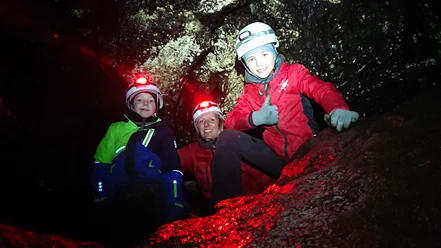
Through the Wolfsschlucht gorge, we reach the Polenztal valley via well-built steps, where we turn right, follow the Polenztalweg for a short distance, cross the bridge to the left behind the Zum Polenztal inn and ascend through the picturesque Schindergraben to Hohnstein. There is the possibility to stay overnight in Hohnstein.
Tour information
Cultural Interesting
Equipment
Directions & Parking facilities
Reißiger Platz stop or Königstein S-Bahn stop line S1
Bus lines241, 242, 244, 246
Departure:
Hohnstein Markt stop
Bus lines 237, 254, 236
More information and timetable information at https://www.vvo-mobil.de/
Additional information
Thanks to good public transport connections in the area and a well-branched network of marked hiking trails, the route can be varied or shortened in many places.
Author´s Tip / Recommendation of the author
Safety guidelines
Path markings in the National Park
Further information about the National Park, for example about the rules that apply there, can be found on the National Park website.
Nearby


