On the E3 through Saxon Switzerland - Stage 3: From Bielatal to Königstein


- 3:35 h
- 12.36 km
- 305 m
- 488 m
- 114 m
- 422 m
- 308 m
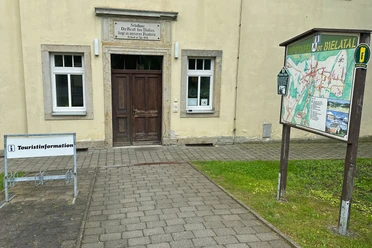
- Start: Bielatal
- Destination: Kingstone
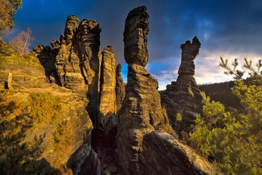
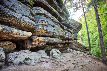
Bielatal - Panoramahöhe - Labyrinth - Bernhardstein - Rock Labyrinth - Harald Schurz Trail - Königstein Fortress - Königstein

Good to know
Pavements
Best to visit
Directions
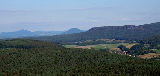
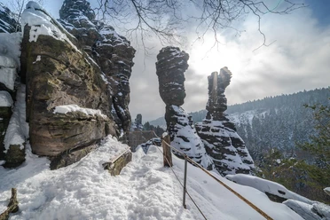
From the village of Bielatal, we follow the "green dot" to Panoramahöhe. From there, we head towards the labyrinth, briefly crossing the road again before entering the forest once more. On the right, we come to the panoramic view from the Bernhardstein. The descent takes us to the rock labyrinth in a short time, which we can explore on a detour. At the crossroads before the labyrinth, the E3 turns right onto Hirschstange, which we follow to the road between Königstein and Leupoldishain. On the way, there are unobstructed views of the Pfaffenstein, Lilienstein and Königstein Fortress. On the other side of the road, the Harald Schurz Trail branches off; we follow this and the Donkey Trail to Königstein Fortress. At least two hours should be allowed for a visit to the fortress. The descent from the fortress leads partly via steps into the town center of Königstein. The stage ends here, and the next stage follows with the crossing of the Elbe by ferry.
Tour information
Cultural Interesting
Equipment
Directions & Parking facilities
Bielatal Reichstein stop
Bus routes: 245, 242, 247
Departure:
Reißiger Platz stop or Königstein S-Bahn stop line S1
Bus routes
241, 242, 244, 246
For more information and timetables , visit https://www.vvo-mobil.de/
Additional information
Thanks to good public transport connections in the area and a well-branched network of marked hiking trails, the route can be varied or shortened in many places.
Author´s Tip / Recommendation of the author
Safety guidelines
Nearby