Weißig: Over the Rauenstein table mountain


- 1:20 h
- 4.04 km
- 124 m
- 124 m
- 203 m
- 286 m
- 83 m
- Start: Bus stop Weißig
- Destination: Bus stop Weißig
Bus stop Weißig - Berggaststätte Rauenstein - Gratweg - Bus stop Weißig

Good to know
Pavements
Best to visit
Directions
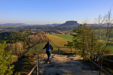
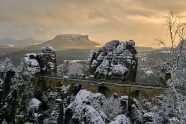
The ridge path, which the mountain club for Saxon Switzerland began building back in 1885 (cost at the time: 603.50 marks), continues to the northwest. There are numerous views along the way - of the Elbe valley, the Bastei, the Weiße Brüche or southwards to Königstein Fortress. About 50 meters after the ascent steps join the ridge path, there is a marked rock face with plaques where the brave can climb up to the Kapphöhle - a small rock hole with a view of the Bastei (no handrail, surefootedness required).
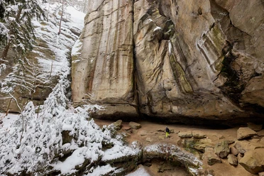
At the end of the ridge path, the trail turns sharply to the east. There is a stone table - a nice place for a picnic. Shortly afterwards, you will pass the Pudelstein natural geological monument: an approximately 300-metre-long rock face with small, wart-like, spherical formations of brown iron - a geological feature of the region. The return route runs south of the elongated rock massif via TK 14 back to the starting point at the Weißig bus stop.
Tour information
Loop Road
Stop at an Inn
Summit
Equipment
- Onion-skin clothing and winter hiking boots
- Backpack with hiking map, snacks, thermos flask with a warm drink, smartphone, flashlight, first aid kit
- Hiking poles, ice goggles
Directions & Parking facilities
Bus route 246
Bus stop Weißig
More information and timetable information at: https: //www.vvo-mobil.de/
Safety guidelines
Map
Nearby


Download GPX file