From Stadt Wehlen via the Bastei Bridge to Kurort Rathen


- 2:00 h
- 5.79 km
- 250 m
- 252 m
- 112 m
- 317 m
- 205 m
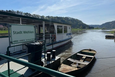
- Start: Stadt Wehlen station
- Destination: Kurort Rathen station
Stadt Wehlen station – ferry to the right side of the Elbe – Schwarzbergweg – Steinerner Tisch – Bastei – (Neurathen rock castle) – Kurort Rathen – reaction ferry to the left side of the Elbe – Kurort Rathen station
The Neurathen rock castle has not been accessible for a long time due to safety deficiencies. However, it is planned to be secured again and made accessible to visitors in the future. The tour is worth it even without the rock castle!

Good to know
Best to visit
Directions
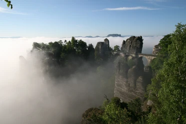
From here, we follow the Fremdenweg past the snack bar, which leads us to the Bastei Bridge (we are still on the Malerweg). This probably most famous bridge in Germany lies almost 200 meters vertically above the Elbe. In 1851 the stone bridge was built; before that, the rugged rock ridge was accessible by a wooden bridge. From the Bastei Bridge and the surrounding viewpoints (e.g. Ferdinandaussicht, Wedding Pulpit), we have magnificent views of the landscape. In 2023 the panoramic viewpoint to the right of the bridge was built. There are also various snack options here.
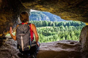
After crossing the Bastei Bridge, we reach the Neurathen rock castle. It was one of the oldest and largest fortifications in Saxon-Bohemian Switzerland, then known as the double castle Alt- and Neurathen. It was first mentioned in the 13th century. Traces of the original dwelling and fortification can still be found in the rock – valuable traces to reconstruct the past. Currently, however, the rock castle cannot be visited as it had to be closed due to safety deficiencies.
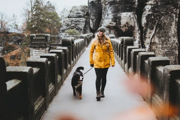
We descend the Bastei trail down via steps until we reach the Kurort Rathen. On the way down, we follow the blue stripe because the Malerweg branches off to the Amselsee – a place to pleasantly relax by boat in good weather!
Well deserved is now the stop at one of the numerous restaurants in the Kurort Rathen before we cross over by the reaction ferry to the station on the left side of the Elbe.
Tour information
Cultural Interesting
Stop at an Inn
Summit
Directions & Parking facilities
Departure: Kurort Rathen S1
Additional information
- All rules in the national park
- Tips for safe hiking in Saxon Switzerland, created in cooperation with the mountain rescue service
- Notes on dealing with deadwood especially for hikes through dead spruce forests
Author´s Tip / Recommendation of the author
Note: On weekends or public holidays, it can be very crowded on the Bastei Bridge especially between 10 a.m. and 6 p.m.!
Safety guidelines
Please note: The tour runs through the Saxon Switzerland National Park. Paths must not be left here and dogs must always be kept on a leash. In the core zone (recognizable by signs in the area), only marked paths may be used. Violations may result in fines. Please also make sure to take your rubbish (including food leftovers and tissues) with you again.
Further information about the national park, for example about the applicable rules and the trail markings, can be found on the national park's website.
Map
Sachsen Kartographie Dresden GmbH: Vordere Sächsische Schweiz
Nearby