Road cycling route through Saxon Switzerland


- 5:55 h
- 97.88 km
- 1,329 m
- 1,329 m
- 112 m
- 465 m
- 353 m
- Start: Central bus station/train station Pirna
- Destination: Central bus station/train station Pirna
Not only the marked cycling routes in the national park, but also the Königstein-Bahratal-Cunnersdorf area can best be explored by road bike or gravel bike. Behind almost every corner, a new panorama opens up. This route leads on bike paths north of the Elbe valley and offers insight into the stone areas around Gohrisch and Königstein.

Good to know
Pavements
Best to visit
Directions
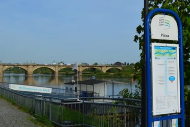
One of my favorite routes starts in Pirna. Initially, you head north over small, winding roads out of the Elbe valley, then cross the countryside through small villages to the first intermediate destination Stolpen. The path continues to Neustadt and then climbs over a long ascent to Sebnitz. Behind the city of silk flowers, we pedal up over the Hochbuschkuppe to one of the most beautiful panoramic roads in the region. From Altendorf, we seem to roll directly towards the Lilienstein, but then make a detour towards Bad Schandau where we cross the Elbe. On the other side of the valley, it goes uphill again towards Gohrisch. Just below the Papstein, we turn left and let the bike roll past the Pfaffenstein with views of the Königstein fortress. One of the last climbs is overcome just behind Leupoldishain. Through Struppen, we buzz down with wonderful views over the region directly into the Elbe valley where we either cross again to Wehlen or continue directly on the Elbe cycle path back to Pirna to enjoy the end of the day in the old town.
Tour information
Loop Road
Stop at an Inn
Directions & Parking facilities
P+R Pirna
Elbe parking lot Pirna
Arrival possible with S-Bahn S1; route starts possible in Pirna, Stadt Wehlen, Königstein, Bad Schandau
Arrival with Regionalbahn RB 71 towards Sebnitz, route start in Stolpen
Author´s Tip / Recommendation of the author
Nearby



Download GPX file