Cunnersdorf: Katzstein, Rotstein and Spitzer Stein


- 4:30 h
- 13.53 km
- 321 m
- 321 m
- 248 m
- 463 m
- 215 m
- Start: Gohrisch OT Cunnersdorf stop Deutsches Haus
- Destination: Gohrisch OT Cunnersdorf stop Deutsches Haus
Cunnersdorf - forest bath - Katzsteinbaude - Signal viewpoint - Katzstein - Schneebergblick - Rotstein - Spitzer Stein - Cunnersdorf

Good to know
Pavements
Best to visit
Directions
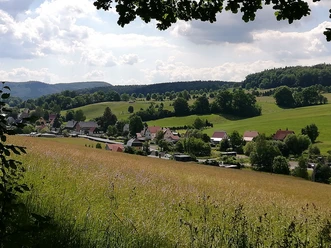
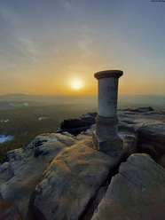
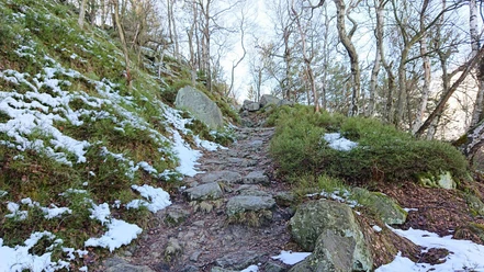
Cunnersdorf, a district of the spa town Gohrisch, is the starting point of this hike. It begins at the "Deutsches Haus" stop or the parking lot in Cunnersdorf and immediately turns right towards the Cunnersdorf Bath along the Nature Trail. After the forest bath, we turn right off the road and continue following the diagonal green line marker. After about 300 meters, you reach a clearing rising to the left, at the end of which the path steeply ascends to the left towards Katzstein. After a few meters and an iron ladder, you reach the elongated ridge. The Signal, a rock pulpit with a magnificent view, is the first highlight on the right. Following the ridge always southwards, you pass the Katzfels with a steep ladder and weather vane. The platform at the top is quite narrow and may require a few minutes' waiting time if hikers are already up there. Halfway up the ladder, you can discover the cat carved in stone.
The path continues to the Schneebergblick, another viewpoint. The path now changes to the other side of the slope between towering rocks and gently descends to a wide forest road. Shortly afterward, the climb to Rotstein begins. Upon reaching Rotstein, there is a good opportunity for a picnic, as almost half of the route has been walked. Afterwards, the path descends again along a forest road.
This runs mostly flat after a sharp right turn at an intersection. You follow the root path for about 4 kilometers until it transitions into a narrower, unpaved trail, passing a shelter with a resting area. Here, you ascend half-right and follow a path to a signpost indicating the "Spitzer Stein." Iron ladders must again be climbed to reach this viewpoint. Back on the hiking trail, continue towards Cunnersdorf. Soon you reach the nature trail again and follow the yellow line marker on the left and later the red line (Winterleitenstraße) back into the village.
GPS data updated 2022
Tour information
Loop Road
Stop at an Inn
Summit
Tour with Dog
Equipment
Sturdy footwear recommended
Directions & Parking facilities
Motorway towards Dresden, at the Dresden-West motorway junction take the A17 towards Prague. At the Pirna junction, exit towards Pirna. In Pirna, turn right onto the B172 and follow it to Königstein, continue at the roundabout taking the first exit and after about 400 m turn left towards Pfaffendorf and continue to the district Cunnersdorf.
Parking lot "At the Cunnersdorf forest bath" (The hiking route can also be started here.)
Additional information
Food stop: Katzsteinbaude - simple and rustic
Literature
Buy here: Hiking guides
Author´s Tip / Recommendation of the author
Map
Order now: Hiking maps
Nearby

Download GPX file