Goetzinger height


- 3:00 h
- 8.40 km
- 88 m
- 88 m
- 331 m
- 420 m
- 89 m
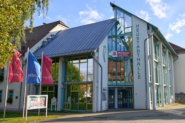
- Start: New Town Hall
- Destination: New Town Hall
Route: Neustadthalle - Promenadenweg - Götzinger Höhe - Promenadenweg - Mittelweg - Hungerweg - Tännigtweg - Neustadt

Good to know
Pavements
Best to visit
Directions
The starting point is the Neustadthalle. Walk along the main road across a crossroads in the direction of Bruno-Dietze-Ring.
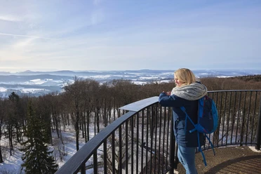
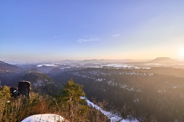
An alley-like forest path leads along the edge of large blocks of flats to the foot of the Götzinger Höhe. This is a really nice walk and in between the trees you can see the observation tower and the restaurant on the Götzinger Höhe. This is reached quite quickly after a short climb. If you want to stop off here, it is advisable to reserve a table in advance. Many people come here at the weekend. Warmed up and refreshed, continue south along the promenade path. Here you cross a road twice before reaching the Mittelweg. Even during the day, the low winter sun creates very different impressions in the forest. The paths are well signposted and you will quickly find your way. On the Tännigtweg, you pass the trout breeding ponds of the Ermisch fishery and can see the large forge of the former "Fortschrittwerk" in the distance. On Kirschallee, you then pass the huge parking lot of the "Capron" motorhome factory. Passing the Neustadt municipal swimming pool, the route then continues along Struvestraße and through Arthur Richter Park back to Neustadthalle.
Tour information
Loop Road
Stop at an Inn
Equipment
- Onion-skin clothing and winter hiking boots
- Backpack with hiking map, snacks, thermos flask with a warm drink, smartphone, flashlight, first aid kit
- Hiking poles, ice goggles
Directions & Parking facilities
to/from Neustadt: RB 71, Bus 261
Timetable information: www.vvo-online.de
Author´s Tip / Recommendation of the author
Safety guidelines
The hiking trails are not cleared of ice and snow. Please refrain from the winter hike in icy conditions.
Map
Winter hiking map Saxon Switzerland
Edition with 40 selected hiking routes including winter stops
Nearby

Download GPX file