With hunger to the Unger


- 3:30 h
- 11.29 km
- 208 m
- 208 m
- 331 m
- 525 m
- 194 m
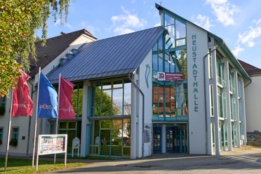
- Start: New Town Hall
- Destination: New Town Hall
Course: Neustadthalle - Freibadsee - Lindenweg - Rugiswalde - Hängeweg - Unger (Prinz Georg Turm) - Georgenweg - Götzinger Höhe - Neustadthalle

Good to know
Pavements
Best to visit
Directions
The start of this route is at the Neustadthalle. Head east along Struvestraße towards the Neustädter Stadtbad. Here you can take a brief look at Langburkersdorf Castle as well as the Götzinger Höhe. The route continues along the Lindenweg to Rugiswalde. Shortly before Rugiswalde, the view to the east of the Bohemian hilly landscape around Horni Poustevna opens up beautifully. If you have started early, you can treat yourself to a sledge ride in Rugiswalde even if the snow conditions are good.
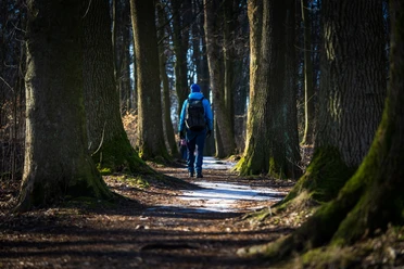
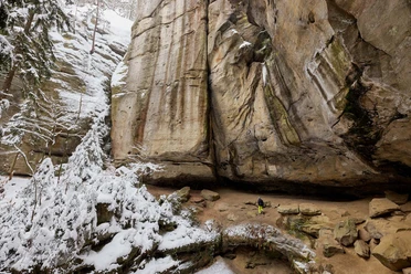
Even if it's hard to believe, it's not far to Unger. After crossing the Sebnitz road, a paved and very straightforward path leads up the mountain before turning into a beautiful forest path just before the Ungerturm. The "Ungerberg" restaurant invites you to take a break here. A climb up to the Prinz Georg Tower is definitely not to be missed. If you continue on after a refreshment stop, keep your eyes peeled. The Georgenweg trail leads directly behind the observation tower into the forest. This path can easily be overlooked on the small overview map (winter hiking map). If you then follow the "red line", you will reach the Mittelweg after crossing Ungerstraße. Now follow the red line to the Götzinger Höhe. There you have the opportunity to climb another observation tower. The trail then leads along an alley-like forest path and continues along the red line back to the Neustadthalle.
Tour information
Loop Road
Stop at an Inn
Equipment
Directions & Parking facilities
Additional information
Author´s Tip / Recommendation of the author
Safety guidelines
The hiking trails are not cleared of ice and snow. Please refrain from the winter hike in icy conditions.
Map
Nearby


Download GPX file