To the Pravčická brána


- 4:00 h
- 8.07 km
- 315 m
- 339 m
- 142 m
- 433 m
- 291 m
- Start: Hřensko
- Destination: Hřensko
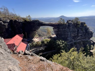
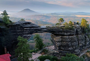
At the Pravčická brána there are numerous viewpoints from which you can enjoy an impressive view of the surrounding region. Caspar-David-Friedrich was also active in the area of the Pravčická brána to see the Rosen- and Kaltenberg up close and found inspiration here.

Good to know
Pavements
Best to visit
Directions
The route starts in Hřensko at the height of the bus stop "Hřensko, water treatment plant" and the parking lot "Hřensko Waterfall". From here, a small path on the left first leads up the street. The red line trail marking serves as orientation along the entire route. After about 50 m, the path leads onto a footpath and you follow the street for about 1 km further uphill. Here you can already see the traces of the forest fire in summer 2022. On the left, at an information board and at the bus stop "Hřensko, Pravčická brána", the hiking trail to the Pravčická brána now branches off. Here the path leads about 1 km gently uphill straight ahead. At the next fork, the path continues to the right. Follow this path further towards the Pravčická brána. Already here you get the first wonderful views into Bohemian Switzerland. Shortly before the goal there is again a somewhat steeper ascent. To avoid long waits at the entrance to the Pravčická brána, purchasing an online ticket is recommended.
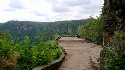
At the top there is a small tourist information and the Falkennest restaurant. Behind the tourist information, a path leads left further uphill to some very recommended viewpoints that you should not miss.
The return journey is via the same route.
Place of inspiration for Caspar-David-Friedrich
In May 1808, Caspar-David-Friedrich set off on a hike into Bohemian Switzerland. His goal was the area of the Pravčická brána to see the Rosen- and Kaltenberg up close. He was on the move for three days and made four sketches on one sheet. Friedrich had climbed Winterberg, crossed the Bohemian border and continued towards the Pravčická brána. That was the usual route of the foreigner's path at the time. Today it is no longer possible to reach the Pravčická brána via this historic route. This route is a very good alternative to follow his tracks in Bohemian Switzerland.
Tour information
Stop at an Inn
Equipment
Sturdy footwear is required!
Directions & Parking facilities
Parking options:
Hřensko, parking lot near the waterfall
Hřensko, parking lot Pod Skalou
Bus connection 434 on the route Děčín - Jetřichovice - Krásná Lípa - Hřensko
Bus connection 435 on the route Mezná - Hřensko - Schmilka (operates on weekends, in July and August also daily)
Bus connection 438 on the route Děčín - Hřensko - Mezná Louka - Mezná
Shuttle bus 441 on the route Mezná via Hřensko and Janov, Hájenky to Česká Kamenice (operates on weekends, in July and August also daily)
Stops:
Hřensko, Pravčická brána
Hřensko, water treatment plant
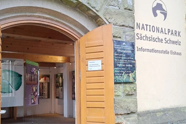
Additional information
Opening hours of the area at the Pravčická brána:
March 28 - October: daily from 10:00 to 18:00
November - March 27: Friday, Saturday, Sunday from 10:00 to 16:00
Admission fee:
Tickets for the Pravčická brána can be purchased online here.
Nearby