Hike from Königstein over Lilienstein to Kurort Rathen


- 3:40 h
- 11.41 km
- 394 m
- 394 m
- 113 m
- 409 m
- 296 m
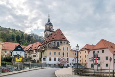
- Start: Königstein
- Destination: Kurort Rathen
Königstein - Elbe ferry - Halbestadt - Ebenheit - Lilienstein - Blue stripe marking (long-distance hiking trail) - Kurort Rathen - Amselsee - crossed in Kurort Rathen by cable ferry to the other side of the Elbe - train station

Good to know
Pavements
Best to visit
Directions
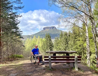
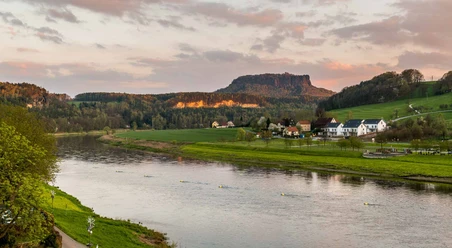
From the train station or parking lot in Königstein, the path takes us across the Elbe via ferry to the other bank (Halbestadt). From here, we go up to the Königsteiner Ebenheit. There we follow the signage to Lilienstein. Upon reaching the foot of Lilienstein, we now climb up stairs and ladders to what is probably the most beautiful table mountain in Saxon Switzerland. Here, you can enjoy views in all directions of the region. After a short descent the same way, we follow the blue stripe marking (long-distance hiking trail) to Kurort Rathen. Arriving in Kurort Rathen, we enjoy the beautiful views over the Elbe, might spot a steamboat, and walk through the town towards Amselsee. In the spa town there are numerous dining options, ranging from snack bars to 4-star restaurants. The Amselsee, beneath imposing rock formations such as "Locomotive," "Beehive," "small and large goose," and "Valley Guardian," offers a peaceful rest or a gondola ride. On the way back, we hike and enjoy the route from the opposite direction and cross to the other side of the Elbe in Kurort Rathen via the cable ferry. The cable ferry must consider ships because of the cable it hangs on, so a small delay may occur during the crossing. Upon reaching the other Elbe bank, we go up to the station so that we can take the train back to Königstein.
Tour information
Stop at an Inn
Equipment
Sturdy footwear required
Directions & Parking facilities
A 17: exit Pirna, continue on B 172 towards Bad Schandau to Königstein
Exit Bahretal, continue on K 8732 to Krietzschwitz, then B 172 towards Bad Schandau to Königstein
Parking garage "Königstein am Malerweg" on the B 172 (turn-off fortress), only 800 m on foot to the fortress
Few parking options in the valley
Arrival:
Line S1:Meissen - Dresden - Königstein - Schöna
241 National Park Line: Pirna – Hinterhermsdorf + 246: Pirna – Königstein | Reißigerplatz
Departure:
With the ferry to Kurort Rathen station, from there the S1
Additional information
Attractive hike with beautiful views; ascent and descent via steps and ladders; information about the national park; dining facilities available; return trip by public transport
Literature
Safety guidelines
Accessible all year round, not recommended on ice and snow slicks, surefootedness required
Please note: only marked paths may be used in the core zone of the Saxon Switzerland National Park! Violations may be fined.
Map
Buy here: Hiking map Königstein - Kurort Rathen
Nearby


