From Rumburk to the Dymnik and back


- 4:00 h
- 12.80 km
- 162 m
- 162 m
- 368 m
- 513 m
- 145 m
- Start: Rumburk station
- Destination: Rumburk station
Die Tour führt von Rumburk durch die Stadt auf den Dymnik (Rauchberg), von dem aus man eine interessante Aussicht über die Region hat. Vom Dymnik geht es dann durch die naheliegenden Wälder wieder zurück nach Rumburk.

Good to know
Best to visit
Directions
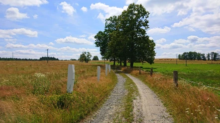
The route starts directly at the station in Rumburk and from there follows the street "Nadrazni" to "Trida 9. Kvetna", which you then follow to the left to the monastery park, where you can learn some things about the Rumburk revolt and see several monuments.
Directly behind the park is also the famous and impressive Loretánská kaple v Rumburku (Loretto Chapel), which is definitely worth a visit.
You then cross the monastery park along the paths, after which you follow the street "Dvorakova" a short way to the left, before turning right onto the street "Sukova" and then immediately left again onto the street "Zimni". You follow this until you reach another park, from where you then initially follow the blue mark to the right for quite a stretch through the town.
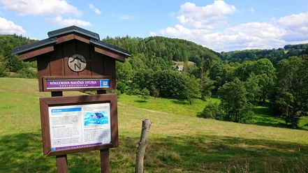
At the sports center, you leave the blue mark and continue following the yellow mark to the mountain hut below the summit of the Dymnik. Then you follow the path up to the summit to the observation tower.
After enjoying the view, you continue behind the observation tower down the path into the forest, where you first follow the yellow mark to the next larger intersection. At this point, you turn left and follow cycle route 3014 to the "Podhaji" reservoir.
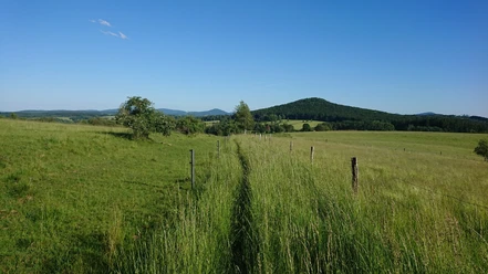
From the reservoir, you then follow the nature trail until you reach the blue mark again, which you initially follow back along the same route through the town to the park where you previously turned onto this path.
From "U Parku" you can then continue to explore the town – visit the museum behind the park and the market square of Rumburk before walking back to the station where the route ends.
Tour information
Loop Road
Directions & Parking facilities
For the arrival, the Nationalparkbahn U28 from Bad Schandau towards Rumburk to the Rumburk station is recommended.
VVO connection information to Rumburk
For the return journey, it is again recommended to take the Nationalparkbahn U28 from Rumburk back to Bad Schandau.
VVO connection information to Bad Schandau
Timetable for Nationalparkbahn U28: https://www.vvo-online.de/de/tarif-tickets/tarif/Nationalparkbahn.cshtml
Author´s Tip / Recommendation of the author
A map of the town and the surrounding area is highly recommended to better orient yourself on site. Otherwise, the track safely leads from start to finish if you have downloaded the offline map beforehand.
There are various places to stop along the route – the restaurant on the Dymnik is highly recommended.
Moreover, the town of Rumburk has a lot to offer, so you should definitely take some time to explore it a bit more at the end of the route.
Nearby
Download GPX file