Stolpen: Hike with a visit to the castle


- 2:15 h
- 7.54 km
- 107 m
- 107 m
- 231 m
- 337 m
- 106 m
- Start: Marketplace Stolpen
- Destination: Marketplace Stolpen
Route: Markt Stolpen - Schützenhausgasse - Kirchsteig (yellow and green line) - Seerosenteich - Rennersdorf - Neudörfel - Rittergut - Helmsdorfer Straße - Wesenitztal - Bischofsweg - Obere Straße - Stadtkirche - Aussicht Bastionen - Burg Stolpen - Markt Stolpen

Good to know
Pavements
Best to visit
Directions
At the next fork in the path, we turn left (green line) and discover a picturesque little pond overgrown with water lilies. Our path continues along the green line in the direction of Schmiedefeld/Großharthau. A few meters later we see the Wesenitz, which has its source in the Lusatian highlands and flows into the Elbe near Pirna after 83 km. From here we follow the Wesenitz valley hiking trail marked with a red dot. At Wesenitztalstraße, we turn left and pass the district of Rennersdorf-Neudörfel until we reach the crossroads on the main road. Turn right at the yellow house.
We follow the road, keep left and walk past the village pond with a small group of boulders. After the unfortunately very dilapidated manor house, we turn left again and cross the Stolpener Landstraße. We continue along Helmsdorfer Straße. After a small group of houses, we turn left onto a path between pasture fences. Here, the Wesenitztal hiking trail leads through the romantic valley along the gently meandering river. On the left, we discover a wooden footbridge on which we reach the other side.
Over a small paved bridge, we take the small path straight ahead, which turns into an impressive, forest-lined hollow path. This is the old Bischofsweg, the medieval connecting road between the main episcopal residence in Meissen and the secondary residence in Stolpen, which became such a deeply cut hollow path due to the once busy wagon traffic.
For the last rest before the final stage, a bench with a flower roundel and sandstone fountain invites you to take a break before turning left onto Obere Straße in the Stolpen-Altstadt district. The Altstädter Kirchlein church is well worth a visit. Continue straight ahead along Obere Straße (blue dot) until you reach Pirnaer Landstraße near the school.
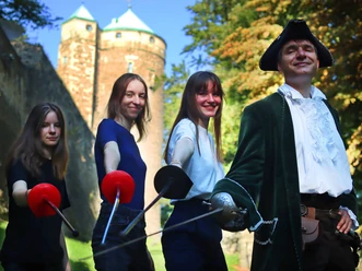
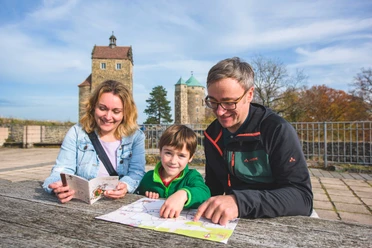
A sign shows us the way left to the town center, which we soon reach via Dresdner Straße and the old town gate. Immediately after the gate, we keep to the right and turn right again into Kirchgasse, taking the steps up to Stolpen town church. Keeping left here, we walk past the monument on the promenade path and left to the bastion view. Continue along the foot of the castle and enter the castle through the gate on the left. After an extensive tour of the castle grounds and the museum, it is not far back to the starting point. All we have to do is walk down the street from the castle and we arrive at the market square. If you have the time and inclination, you can visit the town museum here.
GPS data updated 2022
Tour information
Cultural Interesting
Loop Road
Stop at an Inn
Tour with Dog
Equipment
- Onion-skin clothing and winter hiking boots
- Backpack with hiking map, snacks, thermos flask with a warm drink, smartphone, flashlight, first aid kit
- Hiking poles, ice goggles
Directions & Parking facilities
Stolpen is connected to Dresden and Bautzen via state roads with links to the A6, Radeberg, Pirna with links to the A17, Neustadt in Sachsen and Bischofswerda with links to the A4.
The tourist parking lots in Stolpen are specially signposted and are located on Schützenhausstrasse.
(Parking at the parking lot at Stolpen Castle is only possible for one hour).
Additional information
Literature
Author´s Tip / Recommendation of the author
Open for refreshments - even in winter: Lietze country estate
Safety guidelines
The hiking trails are not cleared of ice and snow. Please refrain from the winter hike in icy conditions.
Map
Nearby


-heike-grunow-cc0.jpg")


Download GPX file