Gottleuba Dam

The Gottleuba dam supplies around 150,000 people in Dresden and the district of Saxon Switzerland - Eastern Ore Mountains with drinking water. It also protects the Gottleuba Valley and Pirna in the event of flooding.
The dam was built between 1965 and 1974. It dams the Gottleuba and Oelsenbach rivers. The catchment area is 35 km². The dam wall is 327 m long, 7 m wide and 53.24 m high.
The reservoir holds 12.97 million cubic meters of water at full capacity, of which 3.5 million cubic meters are used for flood retention.
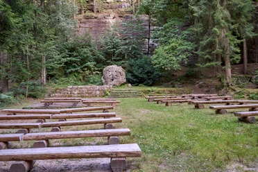
Two public viewing points can be reached from the parking lot in Hartmannsbach in around 700 metres. There is a refuge and an information board above the dam on the G 4 and G 9 hiking trails.
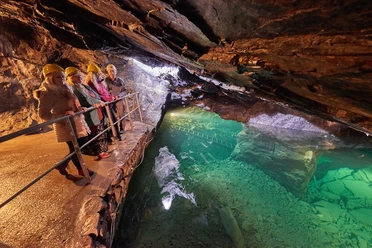
As a drinking water dam, it cannot be used for swimming or water recreation. The dam can only be entered as part of guided hikes.
Guided group hikes over the dam take place regularly on the first and third Sunday of the month or can be booked for groups of 10 to 30 people via the tourist information offices in Bad Gottleuba and Berggießhübel.
The dam was built between 1965 and 1974. It dams the Gottleuba and Oelsenbach rivers. The catchment area is 35 km². The dam wall is 327 m long, 7 m wide and 53.24 m high.
The reservoir holds 12.97 million cubic meters of water at full capacity, of which 3.5 million cubic meters are used for flood retention.
Two public viewing points can be reached from the parking lot in Hartmannsbach in around 700 metres. There is a refuge and an information board above the dam on the G 4 and G 9 hiking trails.
As a drinking water dam, it cannot be used for swimming or water recreation. The dam can only be entered as part of guided hikes.
Guided group hikes over the dam take place regularly on the first and third Sunday of the month or can be booked for groups of 10 to 30 people via the tourist information offices in Bad Gottleuba and Berggießhübel.
Good to know
General information
Parking Available
Bus stop available
Eligibility
for Groups
Pet allowed
Directions & Parking facilities
Easily accessible by public transport.
Bus route: 214
Bus stop: Hartmannsbach, Bad Gottleuba
Footpath: approx. 15 min
Bus route: 214
Bus stop: Hartmannsbach, Bad Gottleuba
Footpath: approx. 15 min
Nearby