- 2:45 h
- 8.65 km
- 137 m
- 160 m
- 114 m
- 229 m
- 115 m
- Start: Kurort Rathen
- Destination: Kurort Rathen
Kurort Rathen – Rhododendronpark – Kleine Bastei – Rathener Folgenweg – Gamrig – Waltersdorf – Liliensteinstraße – Lottersteig – Kottesteig – Kurort Rathen

Pavements
- Street (4%)Asphalt (26%)Gravel (13%)Trail (20%)Path (37%)
Best to visit
- suitableDepends on weather
Directions
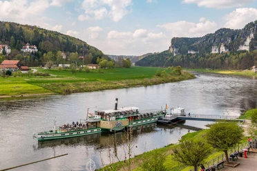
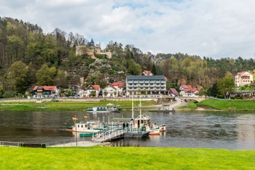
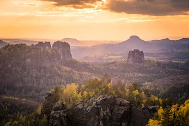
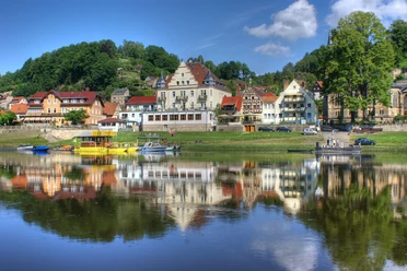
- The hike begins on the right bank of the Elbe in Niederrathen, right at the ferry landing. From the landing, follow the road toward the village center, ignoring the turnoff to the Felsenbühne (rock stage) and Amselgrund on the left. After about 200 meters, a small, winding path—featuring distinct switchbacks and a steep incline—branches off. Ascending this path, which includes some stepped sections, you quickly gain altitude and reach the Rhododendron Park and the Kleine Bastei (Little Bastei) viewpoint in about ten to fifteen minutes. Inside the park, stay on the paved main paths heading uphill; natural stone steps and short trails wind through rhododendrons, magnolias, and other ornamental shrubs. In the upper section, follow the signs pointing to the Kleine Bastei or the weather station. Immediately behind the weather station, a short path with steps leads to the viewpoint. From this secured vantage point, you have a view of the Elbe River, Oberrathen, and the Rauenstein rock formation. After taking in the view, return along the short spur path to the park. Crucially, do not descend back to Rathen via the switchback path; instead, follow the wider upper path eastward through the area of gardens and weekend cottages. The path transitions into the "Rathener Folgenweg." It runs first through open terrain and then through the forest. This wide, mostly gravel path has only a moderate incline as it leads toward Rathener Straße and the Gamrig rock formation. At the end of the Folgenweg, you reach Rathener Straße; turn left here toward Rathen and Gamrig. This stretch of road is just under 400 meters long. Due to vehicle traffic, you should walk in single file along the edge of the road. Afterward, leave the road and follow the forest path to the base of the rock. A few meters further on, a flight of steps leading up to the rocky viewpoint begins on the right. The steps become steeper near the top but are not technically difficult. At the top, a sweeping panoramic view opens up over Rathen, the Elbe Valley, the Bastei area, Lilienstein, Rauenstein, Königstein, and other rock formations of Saxon Switzerland. The sandstone and sandy ground can be slippery, especially when wet or very dry. The plateau lacks continuous safety barriers, so it is essential to stay well away from the cliff edges. Afterward, return to the starting point via the same stepped path. After the descent, keep left on Rathener Straße towards Waltersdorf. Beyond the forest path, the road leads through open meadows and fields into Waltersdorf. Upon entering the village, continue along the main road. In Waltersdorf, walk to the central intersection and turn right (southwest) onto Liliensteinstraße. The route passes the edge of the village and runs near the "Stiller Fritz" inn. Next, follow Liliensteinstraße towards Lilienstein, Halbestadt, or Rathen. By this point at the latest, you will rejoin the "blue stripe" trail marker. The road rises slightly at first before leading out of the village. At the sharp bend in Liliensteinstraße, continue onto Kirchweg and then turn right onto the signposted Lottersteig trail towards Rathen. Lottersteig descends as a narrow forest path. The gradient is moderate at first, followed later by occasional steps and somewhat steeper sections. Exercise extra caution if there are damp leaves or wet sandstone. At the bottom, Lottersteig meets a wider path above the Elbe riverbank. Turn right here towards the resort town of Rathen. Shortly after, you reach the site of the former "Einsiedler" inn/house. From this point on, the path is called Kottesteig; it runs largely level along the wooded Elbe hillside. Through the trees, glimpses of the Elbe, the Rauenstein, and the view back towards Rathen open up at intervals. Stay on the Kottesteig without taking any major turn-offs. The path gradually approaches the built-up area of Niederrathen and finally rejoins the vicinity of the Grünbach Bridge and the ferry landing.
Tour information
Loop Road
Stop at an Inn
Directions & Parking facilities
- ParkingPublic parking lot in OberrathenPublic transportationTake the S-Bahn (line S1) to Kurort Rathen station, then cross the Elbe by ferry to the right bank. Timetable information: www.vvo-online.de
Additional information
- Dining available in the spa town of Rathen: Hotel Amselgrundschlösschen