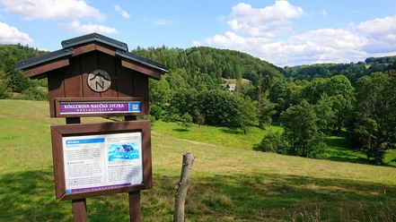
Kögler's Nature Trail


- 6:19 h
- 21.77 km
- 520 m
- 520 m
- 367 m
- 577 m
- 210 m
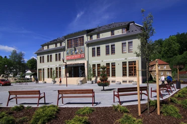
- Start: Marketplace in Krásná Lípa (Schönlinde)
- Destination: Marketplace Krásná Lípa (Schönlinde)
The first nature educational trail in Bohemia was opened by Rudolf Kögler in 1941 at the western edge of Bohemian Switzerland. It was then 12 km long and largely followed the geologically interesting Lusatian Overthrust. After the expulsion of the Sudeten German population (1945), this trail fell into oblivion. However, in 2006 it was reopened as a circular hiking trail of 20 km length along a similar route. In honor of Rudolf Kögler, the path is today called Köglerova naučná stezka (Kögler's Nature Trail).

Good to know
Best to visit
Directions
From Krásná Lípa, follow the hiking sign Green Crossbar (for nature educational trail) south to Vápenka (Limekiln). Here you pass Bohemia's largest deposit of Jurassic limestone, which has been mined since the 17th century. Today, this is a nature reserve with many rare animal and plant species.
Here the trail changes direction to the north. The next destination is Maschkenberg, from where you can enjoy a beautiful view. There is also petrified sandstone here. The silicification of the sandstone arose from tectonic processes during the Lusatian Overthrust and can be seen in the rock by white chert veins.
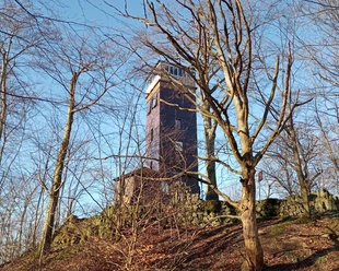
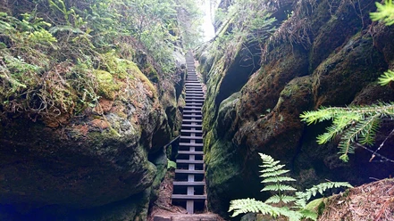
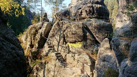
Via Kyjov (Khaa), the hiker reaches the picturesque Kyjovské údolí (Khaa Valley), which is crossed by the Kirschnitz. Here the nature trail runs on the rocks high above the Kirschnitz. Numerous stairs and iron ladders as well as narrow rock crevices and some rock gates must be passed. Then you hike through beautiful forests to Vlčí Hora (Wolfsberg) and to the mountain of the same name (581 m). The observation tower offers an excellent panoramic view from the Ore Mountains over the Elbe Sandstone Mountains, the Lusatian and Zittau Mountains, the adjacent Bohemian Central Mountains with numerous volcanic cones to the Jeschken, Iser, and Giant Mountains. Then it goes down to Zahrady (Gardens), where Rudolf Kögler once lived. Via Snežná (Schnauhübel), a picturesque village with beautiful half-timbered houses, the hiker finally reaches the marketplace of Krásná Lípa again.
Tour information
Loop Road
Directions & Parking facilities
Arrival:
Krásná Lípa (Schönlinde) can be reached from Dresden by S1 to Bad Schandau and then via Rumburk by the National Park Train U28 with a subsequent transfer to the OS 6661 direction: Děčín, hlavni nadrazi or by bus line 001401 direction: Horní Podluží
Departure:
From the Czech Republic, the train connection from Děčín is recommended.
Literature
Author´s Tip / Recommendation of the author
Safety guidelines
Please note: in the Saxon Switzerland National Park, only marked paths may be used in the core zone! Violations may result in fines.
Nearby
Download GPX file