Handbike route "To Fox and Dove Pond"


- 7:50 h
- 33.81 km
- 487 m
- 491 m
- 168 m
- 487 m
- 319 m
- Start: Forsthof Cunnersdorf
- Destination: Forsthof Cunnersdorf
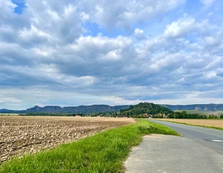
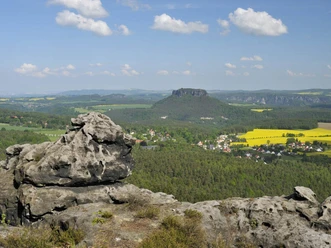
In the southern Elbe Sandstone Mountains, the rocks are only characteristic in the large valleys running towards the Elbe. However, the large forest area between Cunnersdorf and the state border to the Czech Republic is almost uninhabited and thus feels very remote. A large part of the route leads on paved forest roads closed to public motor traffic through this area. Along the route lie not only the Dove and Fox Ponds and the reconstructed historic Brausenstein blast furnace, but also, near the road in Bielatal-Reichstein, as a curiosity, a few abandoned dinosaur models. Mainly the second part of the route then leads back to the starting point on public roads, but these are of secondary importance and therefore less busy. Additionally, there is the option for an alternative shorter route on non-public, partly gravel forest roads.

Good to know
Pavements
Best to visit
Directions
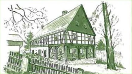
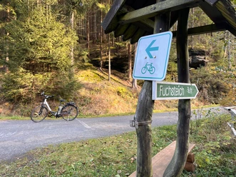
From the striking building at the junction to the forest swimming pool – the so-called Forsthof – we initially ride on the main road towards Krippen. After the first steep climb, there is a short descent into the valley of the Krippenbach after 2 km. Passing the Furtborn, we now accompany it to a fork after 2.5 km. Here, following the signs, we turn right to the Dove Pond. The long and initially steep climb could be challenging for handbikers with a towing bike in terms of traction. Around 120 meters of elevation must be overcome over another 2.5 km, after which the hard work ends. But caution: the subsequent descent to the Dove Pond has a gradient of up to 18%! At the Dove Pond, a bivouac site of the forest trail with a shelter and fire pit invites you to rest. Now we roll further downhill. While the short variant (see info above) takes us directly back to Cunnersdorf on lovely asphalt, the described loop route leads after 11 km from the start uphill again towards the Fox Pond (see signpost). However, the summit has not yet been reached there. Only at a large crossroads with a shelter does this longest ascent of the tour end after just over 5 km. For that, the hardest part of the ride is finally behind us. The long descent towards Königstein is interrupted only by a short counter climb at the Rosenthal church to reach the valley of the Biela. Of course, you can also roll downhill directly through the village without additional elevation. In the valley itself, a short stop halfway in the village of Bielatal-Reichstein (around km 24.2) is worthwhile because of the dinosaurs by the wayside (see author's tip). About 4 km before Königstein, we must turn sharply right for the last time; the yellow street sign to Cunnersdorf is not to be missed. On the mostly moderately ascending and winding road, we finally return to the starting point.
Tour information
Loop Road
Directions & Parking facilities
From Pirna on the B172 to Königstein and at the roundabout take the first exit, follow the signs to Cunnersdorf. Continue in the Bielatal valley until the junction (to the left) to Cunnersdorf.
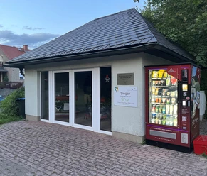
Parking available near the Forsthof in Cunnersdorf
Additional information
Numerous, mostly shorter route variants are possible for the presented tour. For example, it is recommended after the Dove Pond to roll directly back downhill to Cunnersdorf completely free of motor traffic instead of turning left and cycling uphill towards the Fox Pond. The route length is then just over 15 km.
Author´s Tip / Recommendation of the author
Freely accessible dinosaurs in Bielatal-Reichstein, downhill to the right off the main road, directly at the height of the bus stop "Reichstein"
Safety guidelines
Please note: in the Saxon Switzerland National Park, only marked trails may be used in the core zone! Fines may be imposed for non-compliance.
Nearby

Download GPX file