Alternative Bastei Hike - From the Bastei via Rathen to Wehlen


- 2:50 h
- 8.68 km
- 259 m
- 259 m
- 114 m
- 317 m
- 203 m
- Start: Bastei Bus Stop
- Destination: Bastei Bus Stop
As an alternative to the classic “Bastei Loop”—which is currently unavailable due to the closure of the area around Amselsee —we recommend this route. It starts at the bus stop at the Bastei parking lot, leads to the Bastei, and continues down the Basteiweg to the picturesque spa town of Rathen. The route follows the Elbe River to Stadt Wehlen and then climbs through the Schwarzberggrund valley up to the Steinerner Tisch. From there, it’s not far back to the starting point.

Good to know
Pavements
- Street (3%)Asphalt (50%)Gravel (15%)Trail (16%)Path (17%)
Best to visit
- suitableDepends on weather
Directions
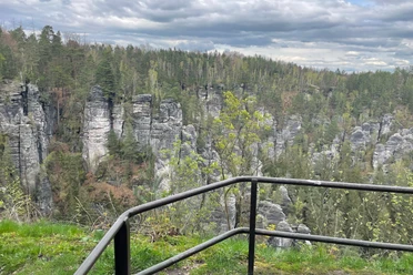
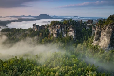
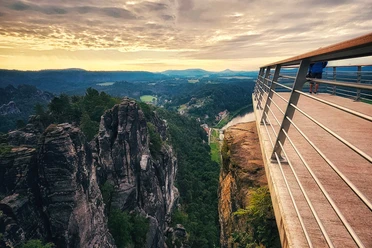
- From the bus stop, walk straight ahead along Basteistraße, past the Bastei Hotel. There you’ll find the observation deck at the Bastei and the many scenic views around the Bastei Bridge. Once you’ve had your fill of the views, head down toward Rathen via the Basteiweg, which includes some steps. In the town, turn right twice and head toward the Elbe. Before reaching the ferry landing, turn right again. You’ll now walk along the Wehlener Weg for quite a while
,
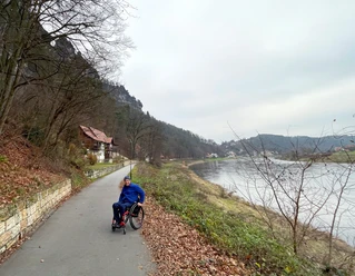
always following the Elbe, until you finally reach StadtWehlen. Once in Stadt Wehlen, you can visit the castle ruins, for example, before walking back a short distance along the Elbe. At a fork in the trail, turn left onto the Schwarzberggrund (Malerweg). The trail heads uphill again. Soon the trail turns right and then immediately left; you’ll now continue partly down steps on the Schanzenweg. To your right, a view of the Elbe opens up.
Continuing along the Malerweg, you’ll eventually reach a large intersection where the “Steinerne Tisch” (Stone Table)—which gives the trail its name—is located. A few meters further on, there’s a rest area, from which you can take the Fremdenweg back toward the Bastei and thus to the starting point of the loop.
Tour information
Loop Road
Stop at an Inn
Directions & Parking facilities
- Public transportationBy Bus to the Bastei: Plan Your Trip
Additional information
- For more detailed information about the forest closure that requires this alternate route: https://nationalpark-saechsische-schweiz.de/faq-zur-situation-in-rathen
Author´s Tip / Recommendation of the author
- On weekends, you can stop for a bite to eat at the Steinerner Tisch.
Safety guidelines
- The trail is suitable for dogs that can navigate steps. Much of the route is located within the Saxon Switzerland National Park, where dogs must be kept on a leash. In addition, the national park enforces a “stay-on-the-path” rule, meaning you must not leave the designated trails. In the core zone, only marked or signposted trails may be used.
Nearby





Download GPX file