Lichtenhain circular route


- 5:00 h
- 14.84 km
- 500 m
- 498 m
- 161 m
- 358 m
- 197 m
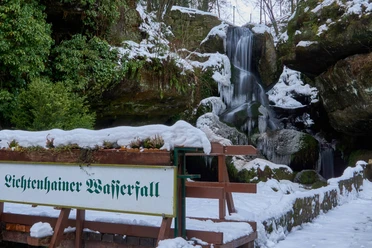
- Start: Lichtenhain waterfall
- Destination: Lichtenhain waterfall
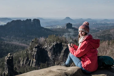
An iconic streetcar, a mystical rock gate, a lost castle, idyllic peaks and hot waffles: the Kirnitzschtal is also a hiking tip in winter.
Winter refreshments open:
Restaurant Forsthaus in the Kirnitzschtal
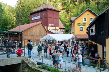
Gasthof Lichtenhainer Wasserfall
Ottendorfer hut
Mountain restaurant Kuhstall
Good to know
Pavements
Best to visit
Directions
We highly recommend taking the Kirnitzschtalbahn from the Bad Schandau spa gardens to the starting point of the tour at the Lichtenhain waterfall. The train with its bright yellow carriages is a rolling legend! With just one line, it is not only the smallest streetcar operation in Germany, but also the only streetcar in the world to enter a national park! Even Hollywood has discovered it for itself.
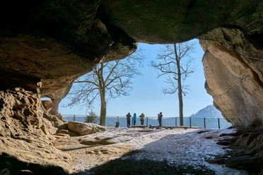
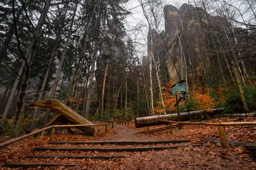
The hike itself starts at the hiking parking lot at the Lichtenhain waterfall. To the right of the large Saxon Switzerland National Park information boards, you first cross the crystal-clear Kirnitzsch river over a picturesque moss-covered stone bridge. The path leads uphill through the forest to Neuer Wildenstein (red dot signpost). The first hiking destination is the "Kuhstall" rock gate. It has been one of the most famous sights in Saxon Switzerland for 200 years. Thousands of tons of rock hang impressively as a vault about ten metres above you as you walk through the rock gate like through the portal of a cathedral into the glistening sunlight on the other side of the mountain. Here we are presented with the first panorama of the day: the rear of Saxon Switzerland with its countless hills and knobbly peaks.
The "ladder to heaven", a staircase in a narrow crevice, takes us even further up - to where the castle of the once proud Bohemian noble family of Berka von der Dubá stood 600 years ago. History has not been kind to the former lords of the castle. They last appeared in the region as robber barons towards the end of the Middle Ages. Their castle was then destroyed. What remains is a romantic rocky plateau with ancient trees and a fantastic 180-degree view. The "Schneiderloch", a small cave with a natural viewing balcony, is also located directly after the descent from the rocky plateau. In general, the winding summit of the Neuer Wildenstein invites you to scramble and explore. Perfect for families with active children. The winter pampering on offer at the Kuhstall mountain restaurant is a perfect match. A cozy, warm tiled stove, freshly baked waffles and hot chocolate: this is the house recipe for cold fingers and toes.
From the Kuhstall, the trail descends into the valley and over the Ferkelschlüchte nis into the Kirnitzschtal to the Felsenmühle (red line). Directly at the Felsenmühle, follow the path back up to the summit of the Großstein (green line trail marker). The forest to the left and right of the path offers a wild sight in places. Several dry summers in a row and a plague of bark beetles led to the death of the spruce trees a few years ago. What remains is a Mikado of dead wood. But young trees are already growing back between the fallen trunks. A new mixed forest is emerging.
"Natural forest conversion" is what the national park administration calls the process that is taking place here and in many other places in the protected area. Man only intervenes to secure paths and roads. Otherwise, the wood is allowed to remain as a natural insect hotel. It is exciting to see how the forest heals itself when it is allowed to.
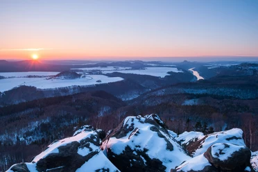
The idyllic summit of the Großstein with its numerous secluded viewpoints is often all to yourself in winter. Here you can enjoy a magnificent panoramic view of the Kirnitzsch canyon and the imposing rocky world of the national park's core zone. Shortly after the descent, the scenery changes completely. Instead of walking through forest and rocks, you walk along a dirt track over open hilly land (green line trail marker).
The former youth recreation home "Endlerkuppe" appears somewhat surreal with its striking water tower on the horizon. It has stood empty for more than 30 years, decaying and waiting for a new purpose.
You then cross the tranquil village of Ottendorf. The Ottendorfer Hütte is well worth a stop here. Like Altendorf, Mittelndorf, Lichtenhain and Saupsdorf, which border the national park to the north, the village is one of the "panorama villages" of Saxon Switzerland. Its exposed altitude north of the Kirnitzschtal valley allows uplifting views of the mountains in the protected area. From the end of Ottendorf, follow the green dot signposts to Lichtenhain. From Lichtenhain it is all downhill to the Kirnitzschtal valley, to the starting point at Lichtenhainer Wasserfall (red line trail marker).
Tour information
Loop Road
Stop at an Inn
Equipment
- Onion-skin clothing and winter hiking boots
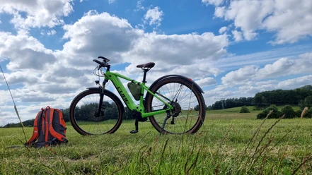
- Backpack with hiking map, snacks, thermos flask with a warm drink, smartphone, flashlight, first aid kit
- Hiking poles, ice goggles
Directions & Parking facilities
Parking lot at the Lichtenhain waterfall
from/to Lichtenhain waterfall: Kirnitzschtalbahn, bus 241, bus 269
Additional information
Author´s Tip / Recommendation of the author
Ride on the Kirnitzschtalbahn to the Lichtenhain waterfall
Safety guidelines
The hiking trails are not cleared of ice and snow. Please refrain from the winter hike in icy conditions.
Map
Nearby
Download GPX file