On the trail of the robber barons in the Kirnitzschtal


- 3:05 h
- 8.85 km
- 322 m
- 323 m
- 201 m
- 381 m
- 180 m
- Start: Buschmühle, Ottendorf (Sebnitz)
- Destination: Buschmühle, Ottendorf (Sebnitz)
Buschmühle - Arnstein rock castle - viewpoint Tägers Wonne - Kleinstein - Buschmühle

Good to know
Pavements
Best to visit
Directions
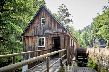
At the Buschmühle – today a stopover in the Kirnitzschtal – our hike begins. On the opposite side of the street from the Buschmühle, the road branches off to Ottendorf and Sebnitz. To the right, the steep climb to the Arnstein begins. At the first intersection, we keep left (marked with a yellow dot and line). We circle half of the Arnstein and climb the designated path up to the former Arnstein rock castle.
In the Middle Ages, the Arnstein was home to a fortification – wooden, relatively small, but fiercely dangerous. From this robber barons' nest, trade routes were raided, and villages plundered. Today, the Arnstein rock castle, also known as Ottendorf robber castle, is one of the fascinating rock castles of Saxon Switzerland, with stone traces of the former wooden structure, rock carvings, and a deep cistern.
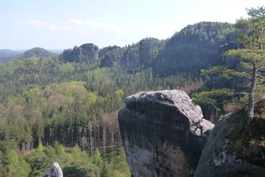
We then descend from the detour to the summit plateau and continue to follow the yellow dot/line to the right, also at the next intersection. After a climb through the forest, we reach the viewpoint Tägers Wonne overlooking the Lorenzsteine, the Großer Winterberg, Winterstein, and Heulenberg. At the next crossroads, we keep right and follow the Räumichtweg marked with a yellow line to the right towards Saupsdorf. We initially hike through a beech forest, later along fields. We approach Saupsdorf but do not enter the village; instead, we turn right, following the red line marking.
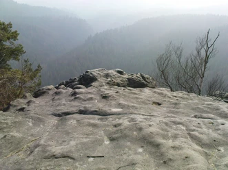
After about half an hour, we reach Kleinstein with views to the Affensteine, the Lorenzsteine, the Zätzschenhorn opposite, and Heulenberg. We reach the Kleinstein cave after descending steep grid stairs. It is – like the Kuhstall – a rock gate about 10 meters high in sandstone.
After the descent, we keep right and continue hiking on the Neuer Weg marked with a red line until we return to the starting point. After the hike, a stop at the Buschmühle is worthwhile.
GPS data updated 2021
Tour information
Cultural Interesting
Loop Road
Stop at an Inn
Equipment
Hiking boots recommended
Directions & Parking facilities
The parking lot near the bus stop only has space for three cars.
Arrival/Departure
Bus line 241 (Pirna - Königstein - Bad Schandau - Hinterhermsdorf)
Additional information
Tourist info Sebnitz: 035971-70960
Literature
Order here: Hiking guidebooks
Author´s Tip / Recommendation of the author
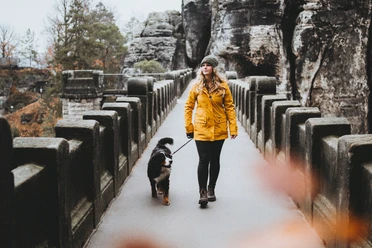
The route is suitable for children, but due to the ladders at Arnstein and very steep grid stairs at Kleinstein, it is not suitable for dogs unless they can be carried.
Safety guidelines
Please note: in the Saxon Switzerland National Park, only marked paths may be used in the core zone! Violations can result in fines.
The route is not recommended in bad weather (wind, rain, snowfall) due to the increased risk of fallen trees. Please be especially careful not to pause under dead trees during the hike. You enter the forest at your own risk!
Map
Buy here: Hiking maps
Nearby

")
Download GPX file