Bad Schandau - Mikulasovice - Tanzplan - Wachberg - Saupsdorf - Bad Schandau


- 2:20 h
- 8.30 km
- 215 m
- 252 m
- 342 m
- 594 m
- 252 m
- Start: Bad Schandau - National Park Station
- Destination: Bad Schandau - National Park Station
We travel to the starting point of this hike from the National Park Station Bad Schandau on the Saxon-Bohemian National Park Railway to the Czech Mikulasovice (Nixdorf) to the stop "Lower Station".
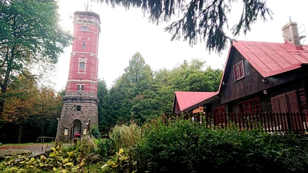
We cross the railway tracks and follow the "Blue Line" marking. Along this sign, a narrow path winds up to the Tanzplan (595 m). This is one of the highest mountains in the Schluckenau tip. Since 1905, there has been a lookout tower on the Tanzplan. Those who climb up will be rewarded with a wide panoramic view of Saxon-Bohemian Switzerland and the Upper Lusatian Highlands. The inn is closed in winter months – the tower is open year-round.
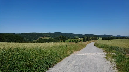
The descent leads over forest paths towards Tomasov (Thomasdorf). We stay on the "Blue Line" marking. Before the village entrance Tomasov, our hiking trail branches off to the left. We follow this for about 1.5 kilometers until a path with the "Green Line" marking turns off to the right.
We cross the German-Czech border and hike to the 496-meter-high Wachberg. From the terrace and the veranda of the "Wachbergbaude", there is a wonderful view into the Back Saxon Switzerland.
Downhill, we follow the "Red Line" marking to Saupsdorf. This place is a small idyll characterized by half-timbered and Umgebinde houses.
Here our hike ends and we take the hiking bus line 241 back to Bad Schandau.

Good to know
Pavements
Best to visit
Equipment
We recommend sturdy ankle-high hiking boots and rain protection. A good physical condition is sufficient for this route.
Directions & Parking facilities
- The National Park Station Bad Schandau is reachable by S-Bahn line S1.
- Parking lot at the National Park Station Bad Schandau
Arrival/ Departure:
- With the Saxon-Bohemian National Park Railway from the National Park Station Bad Schandau to Mikulasovice
- Return from Saupsdorf to Bad Schandau with the hiking bus line 241
- From Bad Schandau by S1 or bus lines
Map
Hiking map Sebnitz and surroundings - scale 1:33,000 - Sachsen Kartographie GmbH Dresden
Nearby


