Short and crisp - on the Forststeig to the Quirl


- 2:20 h
- 5.75 km
- 340 m
- 330 m
- 142 m
- 347 m
- 205 m
- Start: Königstein Abzw. Nikolsdorf
- Destination: Königstein Abzw. Nikolsdorf
Königstein Abzw. Nikolsdorf (bus stop) - Lower Kohlweg - Upper Kohlweg - Marking of the Forststeig - Quirlpromenade - Diebskeller - Quirl viewpoints - Kanonenweg - Sterlhöhlen - Malerweg / Quirlpromenade - Upper Kohlweg - Lower Kohlweg - Königstein Abzw. Nikolsdorf (bus stop)

Good to know
Pavements
Best to visit
Directions
Directly behind the Königstein paper mill, our ascent begins.
We follow the marking of the Forststeig – this is a yellow vertical stroke visible on trees or rocks. The first kilometer goes steeply uphill. From the Lower Kohlweg, turn left onto the Upper Kohlweg (Forststeig). After about 350 meters on our path, where a trail from Königstein-Hütten meets ours, be careful because here we must turn right uphill following the yellow Forststeig mark. After crossing a wide forest road, it soon becomes steeper, and you have to look very carefully for the markings. In several switchbacks, the path winds through dense forest. The next major path we encounter is the Quirlpromenade.
Here we leave the Forststeig and hike the Quirlpromenade to the left to reach the Diebskeller. The Diebskeller is located on the northeast side of the Quirl and is the best-known cave. It was first mentioned in 1692. It is a two-story fissure cave with a length of 28 meters, 8 meters wide, and up to 4 meters high. The stone table inside the cave from 1755 is said to have been set up for a meal during a hunt for Augustus II.
We go back a few meters along the path and climb a steep, unmarked path on the left past a distinctive sandstone wall onto the plateau of the Quirl. Once at the top, a short detour to the right to a small rocky viewpoint is worthwhile.
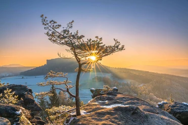
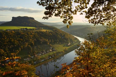
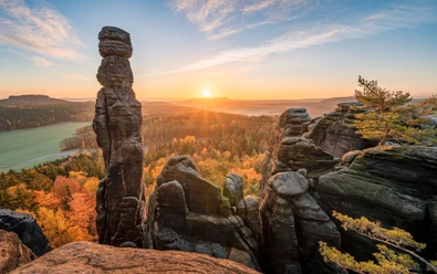
From the northeast side of the Quirl, there is a view of the Königstein fortress and Lilienstein; from the southern tip, you can see the Falkenstein, the Schrammsteine in the distance, the Papststein, Gohrisch with the distinctive Hunskirche, and very close by, the Pfaffenstein. To the south, the vast forests around Cunnersdorf and Rosenthal stretch out, and on the horizon, the Hohe Schneeberg rises.
The Quirl has the largest continuous high plateau of all the table mountains. The plateau is about 1 km long and 350 meters wide. Since the Ice Age, a layer of loam covers the plateau, making it even suitable for fields that farmers established in the 18th century.
We follow the Forststeig marking; the small path winds close to the edge of the cliff until we reach a large rock plateau on the southeast tip of the Quirl. From the Quirl viewpoint, we walk to a fork where we turn left and leave the plateau.
On the Kanonenweg, a path paved with large sandstone blocks, it goes downhill through a rock ridge. To reach the Sterlhöhlen, we take the Quirlpromenade to the left and climb a path about 100 meters up to the rock walls.
They are named after the organ builder and piano tuner Ernst Sterl, who in the 1880s was the leader of a small gang of thieves. The fissure caves served as shelter and storage for the stolen goods.
Back on the Quirlpromenade, we hike toward Königstein on the Malerweg until the intersection with the Forststeig towards the Upper Kohlweg. Then it goes downhill again back to the starting point.
GPS data updated 2024
Tour information
Cultural Interesting
Loop Road
Summit
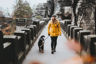
Tour with Dog
Equipment
Hiking boots recommended. Don't forget a flashlight.
Directions & Parking facilities
Schandauer Str. (172) via Bielatalstraße on S171 to the Königstein paper mill
After the turnoff from Bielatalstraße, there is a parking possibility for a few cars on the road towards Cunnersdorf.
Arrival / Departure:
Line 242 (Königstein - Rosenthal)
Additional information
Here you find everything about hiking in the Elbe Sandstone Mountains.
Are you looking for a hotel, a holiday apartment, or a holiday home in Saxon Switzerland?
All our hiking routes with free GPX download can be found directly on our website.
Literature
Order here: Hiking guides
Author´s Tip / Recommendation of the author
This route is suitable for children from 6 years and dogs.
Safety guidelines
Map
Buy here: Hiking maps
Nearby

Download GPX file