Märzenbecher meadows in the Polenztal


- 2:30 h
- 8.68 km
- 122 m
- 121 m
- 216 m
- 338 m
- 122 m
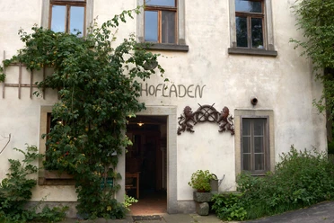
- Start: Village square (market)
- Destination: Village square (market)
Village square in Heeselicht ("yellow line") - Scheibenmühle - Hussite tunnel - Bockmühle ("red dot") - Stolpen ("green line") - Heeselicht

Good to know
Best to visit
Directions
From the village square (market) in Heeselicht we take a small unpaved path marked with the "yellow line" towards Polenztal / Scheibenmühle. The very lovingly designed signposts for the Märzenbecher circular route also provide us with orientation. First, it goes through a beautiful meadow valley past small ponds, then we meet a small paved road at the last houses of the village and hike down the increasingly steep path into the Polenztal. At the Scheibenmühle we have reached the Polenz.
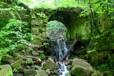
Before crossing the bridge, we want to look for the mouth of the Hussite tunnel. Directly on the bank downstream, we can discover the barred entrance. In the Middle Ages, tin was mined here. It is at least 125 meters long. Now bats regularly take up quarters in it.
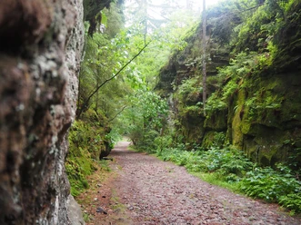
Back at the bridge, we cross the Polenz and hike upstream on the Polenztalweg towards Bockmühle with the marking "red dot." Our path now winds with small ascents and descents through the valley, past granite rocks, small rocky spurs, and the wide Märzenbecher meadows.
The fish-rich Polenz is home to endangered species such as the bullhead. The otter and beaver have also been recorded. Birds found here include the dipper, kingfisher, grey wagtail, and black stork. In addition, evidence exists for eight species of bats.
The Bockmühle (restaurant) is a good place to rest. From here we walk up the road towards Stolpen (marked with a "green line"). At the top, we turn off at the large estate (Luschdorfhof) onto the hiking trail towards Heeselicht (signpost Märzenbecherweg). When we reach the edge of the forest, we see a sign referring to the vanished village of Luschdorf. Passing the fallow deer enclosure with a rest area, we hike back to Heeselicht through meadows and fields.
GPS data updated 2022
Tour information
Cultural Interesting
Loop Road
Stop at an Inn
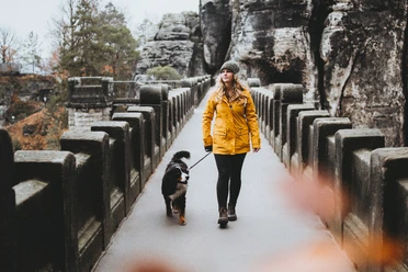
Tour with Dog
Equipment
Sturdy footwear, provisions if needed
Directions & Parking facilities
S161 via Basteistraße to Heeselicht market square
Parking lot at the market in Heeselicht
Arrival/departure:
Bus line 237 (Pirna - Bastei - Rathewalde - Hohnstein - Sebnitz)
Additional information
Tourist Information Stolpen: 03597327313
Literature
Order here: Hiking guides
Author´s Tip / Recommendation of the author
This route is suitable for dogs and families with children. Small children should preferably be carried in a backpack carrier.
Safety guidelines
Map
Buy here: Hiking maps
Nearby


Download GPX file