From Sebnitz via the Panorama Path to Bad Schandau


- 4:32 h
- 16.00 km
- 262 m
- 458 m
- 117 m
- 429 m
- 312 m
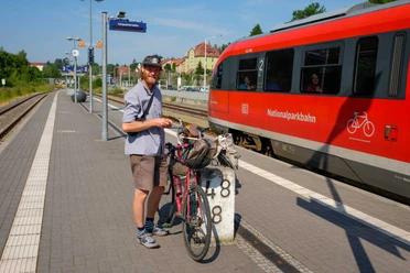
- Start: Sebnitz station
- Destination: Elbe quay Bad Schandau
National Park station Sebnitz (red line) - Lichtenhain (yellow dot) - Mittelndorf - Altendorf - old castle ruins Bad Schandau - Elbe quay Bad Schandau

Good to know
Best to visit
Directions
The route starts at the National Park station in Sebnitz and initially follows the red line through Sebnitz via the market to the local heritage museum, the Africa House, and the Caucasus Room, all of which are definitely worth a visit.
Then it continues along the red line towards Lichtenhain until you reach the Panorama Path, marked with a yellow dot.
From there, you follow the rest of the route along the yellow dot, first to Lichtenhain, then to Mittelndorf, and from Mittelndorf to Altendorf. From Altendorf, continue following the yellow dot to Bad Schandau, passing before that the Schiller View and Schiller Memorial as well as the old castle ruins of Bad Schandau, before the route ends at the Elbe quay in Bad Schandau, from where you can take the ferry back to the station.
GPS data updated 2021
Tour information
Stop at an Inn
Tour with Dog
Equipment
Sturdy footwear
Directions & Parking facilities
Additional information
Tourist service at the House of Guests Bad Schandau: 035022-90030
Tourist information Sebnitz: 035971-70960
Literature
Order here: Hiking guides
Author´s Tip / Recommendation of the author
Refreshment options available: Berghof Lichtenhain and Gasthaus Heiterer Blick in Altendorf. Please check the opening times in advance.
This route is suitable for energetic older children and dogs.
Safety guidelines
Map
Buy here: Hiking maps
Nearby


