+++Aktuelles+++
Informationen zur Begehbarkeit der Etappen finden Sie unter >> Aktuelles.
Werfen Sie einen Blick in die >>FAQs. Hier finden Sie Antworten auf die häufigsten Fragen.
Aktuelles Wetter für Pirna
Wetter Tipps
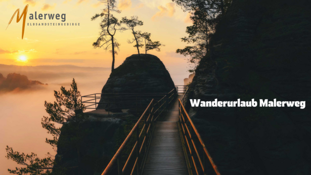
Wandern durch eine der schönsten Landschaften Europas
Informationen zur Begehbarkeit der Etappen finden Sie unter >> Aktuelles.
Werfen Sie einen Blick in die >>FAQs. Hier finden Sie Antworten auf die häufigsten Fragen.
Die Mehrtages-Wandertour durch eine der schönsten Landschaften Europas
Bastei? Check. Festung Königstein? Check. Schrammsteine? Check. Pfaffenstein? Check. Wer einmal den Malerweg komplett gewandert ist, kann behaupten diese und unzählige weitere Highlights der Sächsischen Schweiz gesehen zu haben. Das macht den Weg einmalig. Keine andere Tour durch das Elbsandsteingebirge bietet diese Fülle an Sehenswürdigkeiten! 116 Kilometer ist der, in der Nähe von Dresden gelegene Wanderweg, lang. Von Liebethal führt er durch die wilde Felsenwelt des Nationalparks Sächsische Schweiz bis zur böhmischen Grenze und auf der linken Elbseite durch das Reich der Tafelberge ins Herz von Pirna. Enge Schluchten und endlose Weite, verwunschene Täler und sonnige Höhen, verträumte Dörfer und quirlige Touristenorte: Das alles will der Weg seinen Wanderern zeigen.
Strecke - Die Gesamtlänge des Malerwegs Elbsandsteingebirges ohne Abstecher beträgt ungefähr 116 Kilometer. Auf Grund verschiedener Messmethoden kann es zu Abweichungen kommen. Die Angabe ist also nur ein Richtwert.
Gehzeit - Die gesamte Wanderzeit für den Malerweg sollten Sie bezüglich Kondition nicht unterschätzen. Die angegebene Zeit beruht auf einem durchschnittlichen Erfahrungswert.
Höhenmeter - Der Wanderweg führt über viele Stufen und Leitern durch die Felsenwelt des Elbsandsteingebirges immer wieder bergauf und bergab.

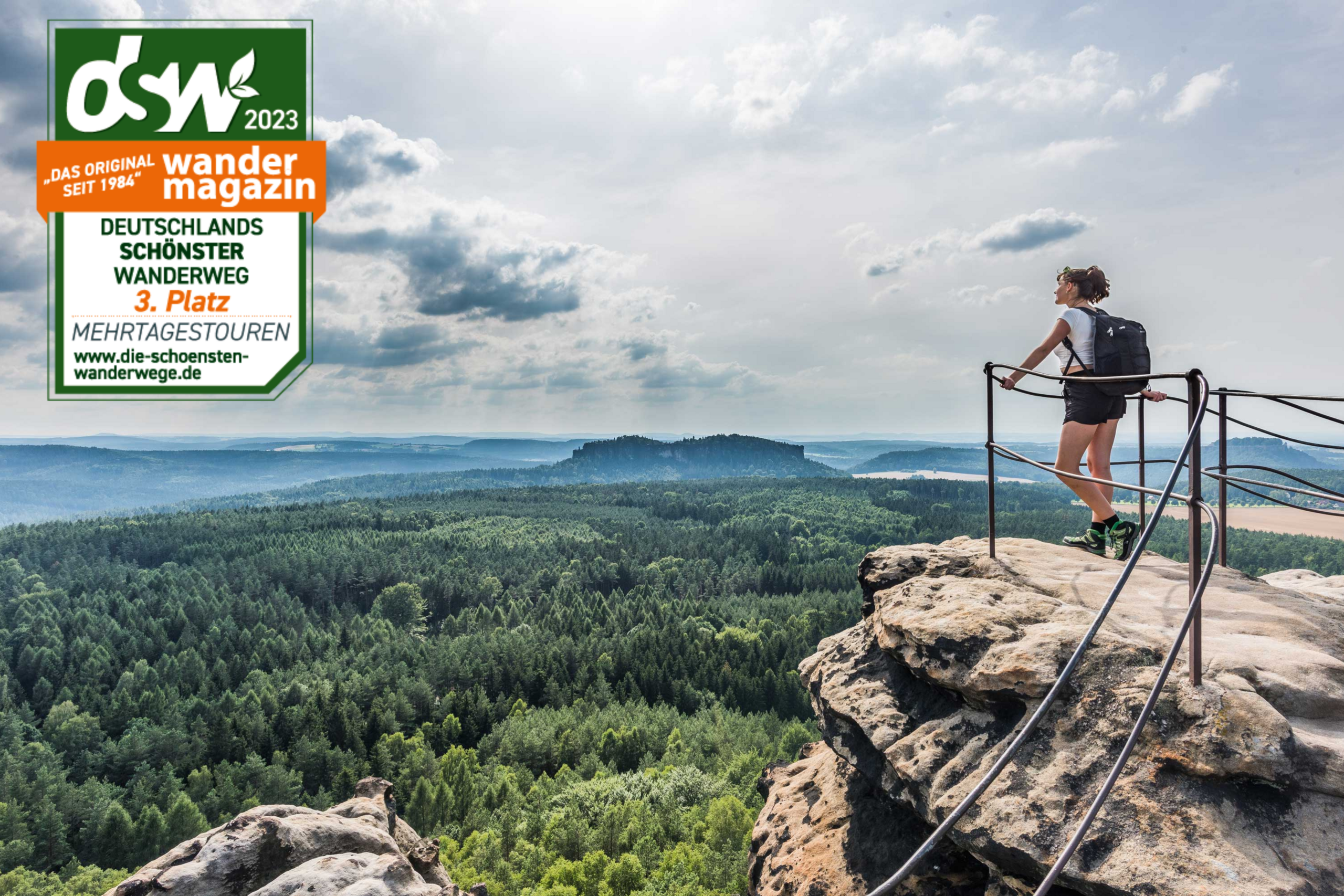
Preisgekröntes Wandervergnügen
Der Malerweg Elbsandsteingebirge hat es wieder geschafft! Von 10 nominierten Mehrtagestouren konnte sich die Etappentour, die auf den Spuren der Künstler der Romantik wandelt, den dritten Platz sichern! Dank zahlreicher Stimmen, darf sich der Malerweg Elbsandsteingebirge über den Treppchenplatz beim Publikumspreis des Wandermagazin freuen.
Im Jahr 2006 ist der Malerweg Elbsandsteingebirge anhand historischer Dokumente rekonstruiert und, angepasst an die Qualitätsansprüche heutiger Wanderer, neu ausgeschildert worden. Bereits ein Jahr danach kürte ihn das Wandermagazin als "Schönster Wanderweg Deutschlands". Ein Jahr später folgte zusätzlich der Internet-Publikumspreis "Beliebtester Wanderweg Deutschlands". Unzählige Reiseberichte, Blogbeiträge oder Pressebeiträge stimmen ein Loblied auf den Malerweg an. Sie bestätigen, dass der Malerweg den Titel schönster Wanderweg Deutschlands verdient. 2016 wählten die Leser des Globetrotter-Magazins den Malerweg nach Patagonien und Island auf Platz 3 der beliebtesten Trips der Welt. Und, wann startet ihr Malerweg-Abenteuer?
Gut zu wissen
Wie anspruchsvoll ist eine Wanderung auf dem Malerweg? Welche Ausrüstung brauche ich für eine Wanderung? Wann ist die beste Reiszeit für eine Wandertour auf dem Malerweg?
Ausführliche Antworten auf diese Fragen finden Sie in der Rubrik:
>> Wanderweg
Romantik pur
Manchmal geht eine Wanderweg unter die Haut. Dann berührt uns die Landschaft auf eine Weise, die wir weder verstehen noch erklären können. Dann wird aus der Tour ein Erlebnis, das noch lange nachwirkt.
Der Malerweg Elbsandsteingebirge ist so ein Weg. Wer ihm folgt, tritt in die Fußstapfen der Künstler, die wir heute zu den Erfindern der Romantik zählen. Sie kamen immer wieder, weil sie hier etwas entdeckt hatten, das es nirgendwo sonst in Europa gab – und gibt.
Lesen hier Sie mehr:
Malerweg-Pauschalangebote
Planen Sie zu zweit oder mit guten Freunden, als kleine oder große Gruppe eine Tour auf dem Wanderweg Malerweg in der Sächsischen Schweiz? Das Erlebnis Malerweg inkl. Hotelreservierung und Gepäcktransport von Unterkunft zu Unterkunft wird für Sie bestens vorbereitet.
Der Buchungsservice des Tourismusverbandes Sächsische Schweiz berät Sie gern, um das passende Angebot zu finden.
Telefon: +49 3501 470147
E-Mail: info@saechsische-schweiz.de
Malerweg-Wanderung selbst planen
Alle Gastgeber auf dieser Webseite tragen das Prädikat »Wanderfreundlich am Malerweg«. Sie wissen, was Malerwegswanderer glücklich macht und bieten unter anderem Einzelübernachtungen, Lunch-Pakete für das gesunde Picknick in der Natur, Unterstützung beim Gepäcktransfer oder Trockenräume für nasse Bekleidung. Wanderfreundliche Gaststätten halten warme und leichte Speisen sowie Getränke auch zum Mitnehmen bereit.
Unser Service
Unsere kostenlose Wanderbroschüre ist eine ideale Grundlage, um eine Tour auf dem Wanderweg Malerweg in der Sächsischen Schweiz zu organisieren. Sie finden übersichtliche Karten zu den Etappen mit Wegebeschreibungen sowie Adressen von wanderfreundlichen Unterkünften und Gaststätten. Ein besonderes Extra ist der Malerweg-Wanderpass: Einfach jede Etappe abstempeln und am Ende der Tour eine Urkunde mit nach Hause nehmen.
Jetzt die >> Wanderbroschüre Sächsische Schweiz gratis bestellen oder gleich Ihr persönliches Exemplar ganz umweltfreundlich auf Ihrem Endgerät abspeichern.
Wanderführer, Wanderkarten, Bildbände, Magazine, Souvenirs...
Wir haben ein kleines, aber feines Sortiment mit vielen nützlichen und schönen Dingen für Malerwegswanderer in unserem Shop für Sie zusammengetragen. Einfach mal stöbern!
>> Service
Sie benutzen offenbar den Internet Explorer von Microsoft als Webbrowser, um sich unsere Internetseite anzusehen.
Aus Gründen der Funktionalität und Sicherheit empfehlen wir dringend, einen aktuellen Webbrowser wie Firefox, Chrome, Safari, Opera oder Edge zu nutzen. Der Internet Explorer zeigt nicht alle Inhalte unserer Internetseite korrekt an und bietet nicht alle ihre Funktionen.